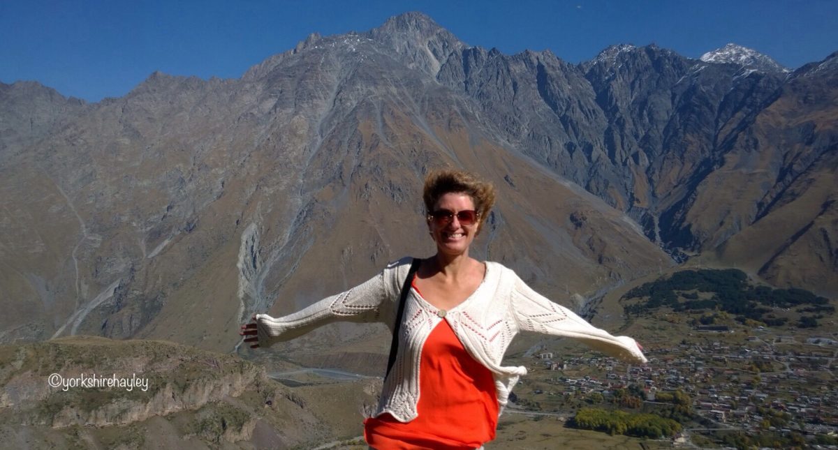

One of the wonderful things about Slovenia is its natural scenic beauty. I’d come here to experience the great outdoors. This is the story of the days I spent crossing the Julian Alps, hiking along the Soča Trail and spending time in the only National Park in Slovenia, Triglav National Park.
I was ready to start my day by driving the 49 hairpin bends of the Vršič Pass which was built by Russian prisoners of war during the First World War. Around 300 of them were killed in avalanches during the construction, so they built a Russian chapel along the road to commemorate them. The Vršič Pass winds for a little under 30 miles through Triglav National Park, so this makes it an incredibly scenic drive.

Helpfully the road has a number on each hairpin so you don’t have to count how many you’ve driven round as you’re going, you can simply think “I’ve only driven around 7 so far?” It was 24 bends up to the top of the pass which is at an elevation of 1611m at its highest point, and then 25 bends down through the Julian Alps. The scenery is beautiful and it was a great day for driving with lovely weather conditions. I got out of the car a few times to take photos of the mountains, but I didn’t do any hiking until I got to the bottom of the pass. I’d planned to walk the Soča Trail which follows the River Soča for 20km or 25km, depending what you read. I was definitely not going to hike all of the Soča Trail, it isn’t even circular, so I’d just have to do a section.
On the final of the 49 bends was a monument to Julius Kugy, a Slovenian mountaineer who climbed peaks in the Julian Alps in the 19th century.

I had read that you could hike to the source of the River Soča, a spring which emerges from a cave, so I drove to the mountain hut which is the starting point of the trail. It said on the signpost it would take about 15 minutes. What the signpost didn’t tell you was what the hiking trail was like.
It was uphill, which I expected. Then I got to the point where there was a steel cable drilled into the rock. As a handrail to help you along the steep climb, I thought. Initially it started that way. Then the cliff ledge got narrower, actually calling it a ledge is being generous, and you’re edging your way along halfway up a cliff holding onto this steel cable. It was terrifying! At one point there was a couple coming towards me and there was nowhere to pass, so I had to go back and find a spot where there was a section of rock wide enough for me to sit down on, I didn’t even trust my balance to stand.

Anyway, after climbing down a couple of iron rungs, I was finally close to the cave. This German family was there with 2 teenage lads who were messing about for ages throwing a bottle attached to a piece of string into the cave, unsuccessfully trying to fill it with the spring water below, totally blocking my view for a photo. Eventually they moved out of the way, I got a photo of the source of the river in the cave and noticed that my shadow was reflected in the photo too. The German family were settled having lunch, it was time for me to head back to my car.

I climbed the iron rungs and got to the steel cable on the side of the cliff. The first section is narrowest, there’s no room at all really, I was hanging onto this cable and I tried to move along. And I realised I was stuck. You know these people who climb the cliff on the beach because the tide is coming in and then they realise they can’t move? That was me! I moved one leg, no that wasn’t going to work, I had a second attempt. Oh my God. What was I going to do? I was just hanging there. The German family watching me must have been extremely amused and thinking what a pathetic wimp I was. I’m not sure how I did it, but I worked out how I was going to move without falling and smashing my head open on the rocks below and after that, it was a bit easier. Thankfully I didn’t meet anyone coming the other way, because there was no way I was going back and doing that again!

The literature I got on the Soča Trail said the path to the source of the river was a safe and well maintained trail. I’m sure if you’re Bear Grylls or a free climber in Utah, the safe and well maintained trail that had you clinging to a steel cable on the edge of a cliff face would have posed no problem. As I don’t fall into either of those categories, I found it a bit more difficult. Always looking for new adventures and challenges and I certainly found one! Legend has it that a dragon guards the source of the River Soča, however, in my case, it was completely unnecessary, that sheer cliff face was enough protection, no dragon required!

I didn’t take any photos of the path to the source of the Soča River, since I was too busy clinging onto the steel cable drilled into the rock and trying not to fall off the cliff. There are plenty of images available on Google of the source of the Soča if you care to look at them, which show you the path and you can decide for yourself from those images whether I’m a pathetic wimp or not!
Not content with that I decided I should hike more of the Soča Trail. Talk about when will I ever learn!

I called in at a Tourist Information Centre for the National Park and asked the bloke there to recommend a section for me to walk. He recommended a section through the gorge which would take about an hour one way. I stopped at a parking spot where there was an information board about cheese making and there was a sign for a farmhouse that let you sample homemade cheese. I walked to the farmhouse and there was a sign saying they had no more cheese left for the year! So with no cheese to fuel me, I followed the trail along the River Soča.

I wasn’t sure how far I’d go along this path, I decided the minute I saw a steel cable embedded into the rock was when I would turn round! I saw the gorge which was very beautiful and it was a very quiet path too, I didn’t meet many other hikers on this stretch. I’m not sure whether there was more of the gorge, but you know when you get to a point where you’ve had enough and even if the best bit is just around the corner you don’t care any more? Actually if I’d known for certain the best bit was just around the corner I would have carried on, but I had no idea, the map was very vague. I’d done over 4km and the further I walked, the further away my car got. I’d be driving this way anyway, so if there was an amazing viewpoint I’d missed, I could stop at the side of the road.

Judging from the drive, I think I did miss some of the gorge, I got out of the car and took a few photos, but I’d seriously had enough by now. I’d planned to hike the Kobarid Historical Trail and there was no chance I’d get to do that today now.
There was one more stop I wanted to try and do before the end of the day, the Boka Waterfall, at 144m it’s the highest in Slovenia. It was only 15 minutes to walk there from the parking by the side of the road. Mind you, that’s what they said about the source of the Soča!

I parked up and decided I really did have to see this while I was passing. It actually only took me about 10 minutes to walk there. You only get to see it from a distance and they’d had a really dry summer so there wasn’t a massive amount of water, but it was definitely worth the walk. So now I’d seen the highest waterfall in Slovenia.
And then it was on to Kobarid which was my overnight stop. I had no time to do anything in Kobarid that night, other than go and get a pizza. I asked them if they did take out and had a glass of wine while I waited. The wine is very cheap in Slovenia, only just over a Euro for a glass, even in restaurants, and it’s generally nice stuff too.

The next day I was heading for Vipava, one of the wine centres of Slovenia and planned to take it easy, not walk so far, as after the past 3 days I felt like my legs were about to drop off. I thought, I’d do the Kobarid Historical Trail in about an hour, then the Tolmin Gorge in about an hour and then spend a lazy afternoon in Vipava and taste loads of wine. You know the saying about the best laid plans?
I went into Tourist Information to get a map of the Kobarid Historical Trail. I was told it was 6km. That must have been the short version the lady in Tourist Information was telling me about. By the end of it I’d hiked twice as far, 12km! Not a bad morning stroll is it, 12km up and down steps, through forest paths that climbed up to the highest area of Kobarid where the castle had been built and then went steeply down to the river? I knew climbing that high would mean a massive descent because I had to cross the River Soča and I could see it way below me.

I followed the signs to see Tonovcov “Grad”, which is one of the few Slovenian words I’d learnt. Grad means castle. And waterfall is “slap”. I was on my way to see Slap Kozjak, that was the main object of me walking the Kobarid Historical Trail. Anyway Tonovcov Grad wasn’t very exciting, it was a 5th century dwelling, there were information boards showing you what it would have looked like, a few bits of wall like you’d see at a ruined castle in England and then this house that was one of the main dwellings, except you couldn’t get inside it because the doors were all locked! This was about the highest point of the walk, the river looked gorgeous, it really is the most beautiful colour. It was also a really long way down.

When I got to the river I got to cross on a swing footbridge. They’re a prominent feature of the Soča Trail and I had almost rejoined it by now. I love swing footbridges, so it was lovely crossing that and then there was a path that took me to the Kozjak Waterfall. It’s nothing like as high as Boka, in fact, it’s only 15m high, but it’s the most famous one because it falls into a cave. I was horrified to spot steel cables again, but it wasn’t like the source of the Soča, it was a nice wide wooden boardwalk. What a luxury! There was a stream to cross with stepping stones. I’m not incredibly keen on them, I tend to slip and end up with soaking wet socks, but I managed to get across without stepping into the water. Then I noticed the bridge… Oh well, I’d use it coming back.

The waterfall is impressive, well worth the hike and it certainly is a beautiful setting, although I’m not convinced the long historical trail I did to see it was entirely necessary. But the route I walked meant I did get to see the church of St Anthony with its surrounding octagonal walls at the top of a series of octagonal steps.
Kobarid is famous for the Battle of Kobarid (or Caporetto in Italian) during the First World War which was a battle on the Austro-Italian front and resulted in a huge defeat for the Italian forces with an estimated 10,000 Italian soldiers killed. Ernest Hemingway wrote about the battle in his novel “A Farewell to Arms”. The church of St Anthony was built in memory of the Italian soldiers who died in this First World War battle and are buried there. The ones who were identified have their names inscribed on the walls of a specially constructed memorial below the church. It was very moving. After that I was back into Kobarid. 3 hours later!

Now I had a decision to make. Did I go the Tolmin Gorge and hike for another hour in Triglav National Park or did I go straight to Vipava and have a relaxing afternoon of wine tasting? Why walk 12km when you can walk 18km? I headed to the Tolmin Gorge.
Triglav National Park is Slovenia’s only national park. And it was worth going to the Tolmin Gorge, it was beautiful scenery. I did all the side hikes including to see the natural bridge that supposedly looked like a bear’s head. I couldn’t see it myself. But it was a nice walk. However, since I did all the side trails, it took me well over an hour to complete. So now it was going to be 4pm before I got to Vipava. So much for my relaxing afternoon of wine tasting. And I was now at the stage where I thought my legs were going to drop off. I was obviously really unfit.

Vipava is a beautiful place and I’d strategically placed myself in accommodation right next to the Tourist Information Centre where they offered free wine tastings. My room for the night was up 3 flights of stairs, so I left my suitcase in the car and just pulled out the few things I’d need for the night, no way I was carrying my big, heavy suitcase all the way up there. I tried a couple of local drinks that were offered to me on arrival, a honey liqueur which was sweet and very nice and a flowery one, no idea what it was, but I liked that too.

Then it was next door to Tourist Information for the wine tasting. They only sold local wines there, from a 20km radius, but there were a huge number to choose from. There were 12 available to taste. I tried them all! Zelen and Pineta are two local white grape varieties that are geographically protected and wine from them can only be produced in that part of Slovenia. As Slovenia exports very little wine and I’d never been before, I hadn’t tasted either. They were both good. And I do know a good wine when I taste one. The last white I tasted I said was extremely good and the best of all the whites. And apparently this winemaker consistently is in the top 10 in Slovenia and lectures at the university on wine making! I didn’t taste a better wine amongst the reds and the semi-sweet Muscat I sampled, so I bought a bottle of the Zelen produced by the top 10 winemaker.

And that concluded my time journeying through the Julian Alps, along the Soča River and my venture into Slovenia’s only National Park. I was going back to my accommodation to sit on my balcony and take in my view of the surrounding mountains. After all my walking today, I deserved a rest!
I travelled to Slovenia during the last week of September 2016.
The Vršič Pass is a mountain pass over the Julian Alps with 49 hairpin bends along its 28 mile length winding through the Triglav National Park. I travelled in the direction of Kranjska Gora to Bovec. Kranjska Gora is approximately a 30 minute drive from Lake Bled and an hour’s drive from the country’s capital, Ljubljana
The trail to the source of the River Soča can be accessed from the mountain hut beside the road to the hamlet Zadnja Trenta. To reach this mountain hut, turn right off the Vršič Pass after the monument to Julius Kugy after the last hairpin bend and follow the road until you reach the mountain hut. Free parking is available on the road. For images of the hiking trail click here
The Soča Trail runs approximately 25km along the course of the River Soča. Information is available from tourist information centres along the route.
The Trenta and Soča Valley websites have lots of useful information about the Soča Trail.
Boka Falls trail can be accessed from the road 4 miles from Bovec. There is an area for car parking, cross the road and the bridge to access the trail. It takes approximately 15 minutes to walk to the viewpoint.
Kobarid Historical Trail is 5km long and is a circular route from the town of Kobarid taking in the Kozjak Falls. It will take extra time to detour to Tonovcov Castle and the Church of St Anthony.
Tolmin Gorges trail is a 4km circuit accessed through the Tolmin Gorges located 2km from Tolmin. There is parking close to the trail entrance. There is an entrance fee of 5 Euros as the gorges are within Triglav National Park.
The Soča Trail, Tolmin Gorge and Vršič Pass are all within the boundaries of Triglav National Park
In Kobarid I stayed at Hemingway House Apartments located in the town centre.

In Vipava I stayed at Guesthouse Koren next to the Tourist Information Centre on the main square. Parking is available, but the street to the back of the guesthouse is very narrow.

If you’re more of a city slicker, read about my time in Slovenia’s capital, Ljubljana.
Ljubljana – My First Taste of the Former Yugoslavia
For more about Slovenia’s neighbour, read about Croatian capital, Zagreb.
Zagreb – City of Museums
For more on European wines, read about my wine tasting experience in Liechtenstein.
Liechtenstein: Wine Tasting in the Prince’s Cellar
Read about a safer descent into a cave than the perilous hiking trail to the source of the River Soča .
Yorkshire: Gaping Gill Winch Meet