Blog

Chile: The Lazy Writer’s W Trek – Days 3 & 4

Hiking through the Enchanted Forest on Day 4 of the W Trek

At the end of my last post, I said I was considering whether to attempt to try and complete the W Trek.

Day 3 was the day to make this decision. If I did Day 3 I would literally be in the middle of nowhere and I would have no choice but to walk on Day 4.

The trail at the start of Day 3 - it does get tougher
The trail at the start of Day 3 – it does get tougher

I didn’t have to walk the middle stroke of the W, but I would have to walk to my next hostel which was another 11 km.

And if I managed that I’d only have one day left so I might as well finish the job and do the final 11 km. Then I had my boat trip the next day.

At the top of the first of many hills at the start of Day 3

I’d been sure to arrange things so I didn’t have to catch any transport at the end of a walk, which meant I had no time pressures. My boat was a morning boat, but I was spending the night before in the hostel the boat went from, so as long as I actually made it there the night before, I would be okay.

Not all of Patagonia is snow capped mountains - some  of it looks like this
Not all of Patagonia is snow capped mountains – some of it looks like this

Again, as mentioned at the end of my previous post, I knew I wasn’t going to give up. The weather was still perfect and I’d never get another chance to come here. So with blue skies and bright sunshine I set off for Refugio Los Cuernos.

Beautiful snow capped mountains in sunny Patagonia

Initially I enjoyed the hike, the views were wonderful, I could see the mountains and the lake, I stopped off a few times to take photos. It was very up and down, not the most difficult hiking, but I had to admit, this was becoming an endurance test now. I was finding this very tough. The day before had been difficult, I really could have done with more rest time in between.

First view of a lake on Day 3 when hiking from East to West

The rough terrain meant I was hiking over large stones some of the time which was hard on my feet, my hiking boots weren’t the most comfortable either. Maybe I should have gone with my old trainers and that would have made it easier. I still didn’t think I’d have been hiking that much faster though. I was careful where to place my feet so as not to slide on loose stones, careful with deep steps so I didn’t lose my balance, careful when there was any water so I didn’t slip. Me being fitter than I was wouldn’t have made any difference to those aspects of my hike. I would still have been taking it very steady when negotiating those sections. But my body was also very tired and carrying a heavy rucksack all day was very difficult.

The trail winds its way by the lake

The other thing I had noticed about this trail was that you had to share it with horses. At first I thought that it was for people who wanted to go trail riding. You could go trail riding in Torres del Paine, but not on the W Trek. The second day I saw the horses on the trail. They were pack horses. One horse in front with a rider on it, leading two or three other horses carrying supplies. I supposed the remote hostels with no road access would have to be supplied by horse, although I did find it difficult to believe that the horses brought everything in. Maybe there was some water access or some off road vehicle access as well. Whatever, there were a lot of horse droppings on the path and I had to be careful to try and avoid any horses on the trail due to my severe horse allergy.

An unusually warm day in Torres del Paine which is notorious for its appalling weather

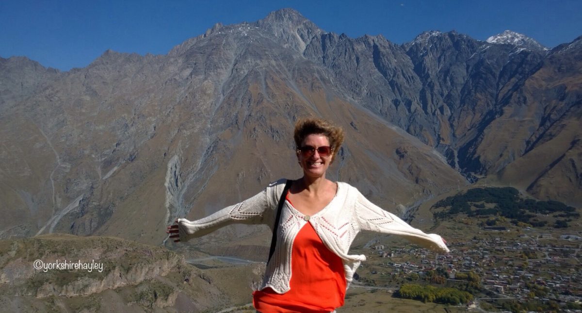
The scenery along the trail on Day 3 was amazing. At the top of the first hill was a fabulous view of a lake and the mountains. There was a wooden swing bridge that crossed a mountain stream and looking back, more spectacular views of the mountains. The trail was never flat, I was relentlessly trekking up and down, it was hard work, but I had better weather than I could have possibly hoped for, blue skies, warm sunshine, unobstructed views of the turquoise lakes and snow capped distant mountains. I was lucky to be here, so I enjoyed the walk as best I could, but Day 3 was the most difficult day for me and I got to a point in the afternoon where I just wanted to get to the hostel. The physical hardships of this hike on my body were now diminishing my enjoyment of being in this magical setting.

If you dare to look up from the swing bridge as you cross, you are greeted with amazing mountain scenery

It was the third night of me staying in a hostel and I’d had enough of that too. The first night had been okay, it was a novelty, it was bearable. The second night where I had sheets and a pillow was quite comfortable, sharing with a French Canadian couple and two German ladies, all a bit older and none of them noisy types. I didn’t like the fact that they didn’t sex segregate the rooms in the hostels though. It wasn’t too bad in there because there was only one man, the husband of the French Canadian couple.

The W Trek continues to wind through the Patagonian wilderness

At Refugio Los Cuernos I was back to the silk duvet and satin sheets, by that I mean sleeping bag and pillow and they tried to put me in a top bunk again. I asked for a bottom bunk, which I got, and was quite annoyed to find that a husband and wife had bagged the two bottom bunks instead of having the same set of bunk beds. The staff had swapped me over with the wife. These rooms had 8 beds to them, three bottom bunks, 3 middle ones and two that practically reached the ceiling. The room was dark and depressing.

Smiling even though I'm now struggling on this last section of Day 3
Smiling even though I’m now struggling on this last section of Day 3

One of the blokes I had to share a room with in this refugio, who was from Argentina, said it was common to have mixed bedrooms in mountain refuges. He said this wasn’t a hostel. Wrong. A mountain refuge hut in the Alps where you shelter from snow storms and avalanches was not the same as this place, specifically built for tourists that had a kitchen, a restaurant, bathrooms (bad as they were) and dormitories. This place had cost me £90 to stay in, the least I could expect was a female only dormitory.

A trek through mountains, lakes and glaciers, what more could you ask for?

The refugio staff have lists of advance bookings, everyone has to have an advance reservation. It’s not difficult to look at your list and say, we’ve got 16 women and 24 men booked for the dormitories tonight, so we’ll put the women in these rooms and the men in these rooms. If you have an odd number, put the couples travelling together in a mixed dormitory. I work in the travel industry and I know this is not a complicated process. It comes down to staff laziness, nothing more. For £90 a night, the guests deserve better service. And if not that, a proper dressing area in the bathroom that wasn’t opposite a door that opened out onto the corridor shouldn’t be too much to ask.

A view of the distant glacier

Yes. In this scabby hostel, the only place to get dressed was in the bathroom because I was in a room with 6 blokes, and the only place to get dressed in the bathroom, unless you went into a toilet cubicle which was very confined and unhygienic, was to sit on the one bench in the bathroom that faced the door. Which meant when anyone opened the door, anyone walking past could you in whatever state of undress you were in. At one point I was half dressed when a lass walked out of the bathroom for something she’d forgotten and left the door open! Presumably she didn’t think it mattered I only had my knickers on and anyone could have seen me in the two minutes she was gone, if I hadn’t got up and shut the door myself.

These swing bridges are a prominent feature of hikes in the National Parks of Chile

I mentioned hygiene in the toilet cubicles. Which brings me to something else. You can’t flush toilet paper. You have to throw it in a bin next to the toilet so you don’t block the drains, which is pretty disgusting. So definitely not somewhere you want to be getting dressed. I came across it all over Chile, not just in the National Park.

My next holiday is going to be super luxury for me. No more hostels where you can’t flush toilet paper!

I couldn't get enough photos of this breathtaking scenery
I couldn’t get enough photos of this breathtaking scenery

On my next holiday I can also choose where to eat. Again, as mentioned in the previous post, I’d had both breakfast and packed lunches at the hostels so far and they’d been practically inedible. I didn’t realise you could actually buy food at the hostels, such as order a pizza, I thought it was their meals or nothing so I thought I should have something, at least breakfast and a packed lunch. Had I known how bad the food was going to be, I would have made do with my emergency supply of biscuits for the day hike and had something at the hostel in the evening because the breakfasts and pack ups were an expensive waste of money.

The hiking trail continues to follow along the lake shore

I just didn’t feel like being sociable any more, I had no desire to go and mix with strangers. To be honest at this point, I wanted this to be over and wished I’d said, forget the money I’ve wasted, this is just not worth it, I’m going back to Puerto Natales.

I was so glad that I hadn’t said that, because this was definitely the low point of the hike and things improved substantially the next day.

I would never have managed the hike without my trekking poles

Earlier in the afternoon I’d been chatting to a lady from Guatemala who was hiking with her niece. She had been carrying the most enormous backpack with a frame that held all their camping gear. If I had had to carry all that stuff I could not have hiked the W Trek. I doubted I would have been able to stand upright with that on my back. Despite feeling antisocial, I saw this lady from Guatemala at a table set outside the hostel and I went to say hello to her and chatted to her and her companions for a while until she left to put up her tent.

On Day 4 the trail starts off on a beach

I then retreated back to the bedroom with Strauss for company. Listening to classical music was the only thing keeping me going in these hostels.  It somehow brought me closer to civilisation. Sophisticated 19th century Vienna, a cultural mecca. I could try to imagine I was overnighting in Schönbrunn Palace, instead of sharing a room with 6 sweaty blokes.

I had to fill in a review about the hostel and it wasn’t good. I’ve used the adjective “scabby” in this post, which is a word I use when I’m generally not very happy with accommodation. I didn’t use this adjective in my review, but I only gave it 1 or 2 out of 5 for everything and only 2 out of 10 as a recommendation, because it was marginally better than a tent and explained that I thought the mixed bedrooms were awful, the bathrooms were inadequate and there was no place to dress in privacy after a shower. If I’d been sharing with all women, I would have got dressed in the room. With 6 blokes in the room? I don’t think so!

Following the lake shore along the beach at the beginning of Day 4

When I got back to Puerto Natales I’d have my own room, when I got to Punta Arenas I’d have my own apartment and when I got home I’d have my own house! I was surprised the Little Angels hadn’t made an appearance on my iPod yet, this Scarborough band always feature when I’m homesick.

I’d had a hard afternoon getting to the hostel, the hostel was easily the worst I’d stayed at along the trek and I was faced with a walk the next day whether I wanted one or not because I was in the middle of nowhere. That night and the following morning were definitely the low point on the trail for me.

A view of some of the islands in the lake

On day 4, I very much doubted I’d be doing the middle stroke of the W. If there had been somewhere to stay at the top of the middle stroke of the W, I would have stayed there and broken up the journey to make it manageable. As it was, it would mean hiking twice as far as I had done today and I had been told that the hike to the top of the middle stroke of the W was quite tough. I’d see how I got on, but I didn’t expect to be seeing Mirador Britanico.

As I set off in the morning I was faced with a big hill to climb, quite literally. A 2 kilometre uphill slog. It was tough at first because it was walking on big stones which is much harder on your leg muscles and also on my poor, sore feet. I came out onto the beach by the lake shore and decided to take a few photos of myself on this lovely beach. I did enjoy my short time on the beach, it was a nice, relaxing and scenic place to be.

A visual guide to how many hills there are on each section of the trail

Then the uphill slog began and on big stones too. I remember walking along Brighton beach almost 30 years ago and remember walking along the shingle being hard on my leg muscles. I was in my early 20s then and very fit as I used to go to the gym most days, and as my university was at the top of a steep hill I would walk up and down that regularly. During my first year when I was living in Halls I used to carry 8 pints of milk all the way up that steep hill from the supermarket! Now I’m complaining about a rucksack! Anyway I’m nowhere near that fit now, so a heavy rucksack and the large stones was a killer. I didn’t even mind the climb as much as the stones. At least this was the beginning of the day.

You can see the new accommodation being constructed for the next season of trekkers in 2021 near the turn off for Mirador Britanico

After that initial climb it did get easier, the path was still up and down, but it did level out somewhat and the view of the mountains, lakes and glacier was wonderful. I started to enjoy myself a bit more.

I got to Camp Italiano which is the point where you turn off to go to Mirador Britanico, the viewpoint that everyone raved about and was second only to the Torres. I looked and I hesitated, but it was 4 km one way and took 3 hours. It might well have taken me longer. It was a difficult path, apparently similar to the Torres where you were climbing on and over boulders and much as I would have liked to have seen this view, I knew I’d never make it and then do another 7.5 km to the next hostel. I was disappointed I wasn’t able to do it, but I didn’t regret not doing it. And that’s the wonderful thing about the internet, you only have to Google “Mirador Britanico” and click on images and you’ll see about a million photos of it. To misquote Jim Bowen on Bullseye, “let’s have a look at what I would have seen”.

Close up view of a glacier on Day 4

If I hadn’t had to do so many long hikes over consecutive days and if I could have changed my trainers, because I usually alternate my footwear, it could have been different. But I couldn’t possibly have carried a second pair of trainers and hiking every day was taking too much of a toll on my body. I was now feeling confident I would get to the end of the W Trek and make it up to Refugio Grey the following day, which was 11 km and didn’t seem to be a particularly difficult section of the trail, but I wasn’t going to manage the full middle stroke of the W.

Heading down towards the camp before the turn off for Mirador Britanico

That’s when I came up with my alternative name. I was doing the lazy writer’s W Trek. A lazy writer will form a “W” where your pen hints in a small upward motion, so you can just about see it is a W. So that’s how I referred to my long distance wilderness hike from then on – the Lazy Writer’s W Trek.

After Camp Italiano, the track up to Refugio Paine Grande was pretty quiet. I think most people had left early from the opposite direction to do the hike to Mirador Britanico or were doing the hike if they’d left from the east. I found a nice quiet spot to eat my pretty horrible sandwich that had been in my packed lunch. I was sitting there for 15 or 20 minutes and not one person passed me from either direction.

Where I am in the world, 51 degrees south, 73 degrees west

One of my favourite places on this day, and indeed on the whole hike, was what I called the enchanted forest. The enchanted forest came after lunch and consisted of lots of dead trees, the type you would find in volcanic areas. It appealed to the romance and mystery in me. Okay, it wasn’t exactly where no man had been before, but I was still in a remote spot that a lot of people would never get to in their lifetime. I was pretty well off the beaten track.

The trees on this section of the trail reminded me of an enchanted forest in a fairytale

There was a bit more of an uphill climb and I was wondering when this uphill battle was going to end and then I got to see the view of Pehoe Lake, which was the most amazing turquoise colour. That must mean that Paine Grande Lodge wasn’t far away. Another beautiful spot on this fabulous hike.

I crossed one bridge and I could see the building, not too far in the distance. Not far now.

This was my favourite part of the trail on Day 4

On first view arriving at Paine Grande Lodge it looks very impressive. They were busy cleaning the windows of the restaurant so you had a nice view out to the lake. It was just a pity they hadn’t thought to clean the rest of the place. It was filthy! I was shown to my room and it was empty so I could have whatever bed I wanted. All of the bedding on all of the beds looked a bit grubby. I had a feeling I would be sleeping on my towel tonight. The staircases needed washing too.

The enchanted forest is not an official name, it was one I made up!

But by far the worst was the shower room. It was filthy. They really needed to invest in new shower facilities. The only good thing you could say about these shower rooms was you could get dressed out of view of the door. And that was the only good thing. I couldn’t even work out how to turn the shower on, I had to ask somebody. Now I haven’t been to the swimming baths for years, so I don’t know if they’re still like this now, but when I used to go, probably around 30 years ago, you had to press a button on the shower and you got water for about 30 seconds and then if you wanted more water you had to press it again. That’s what these were like. Except you didn’t even get water for 30 seconds. You only got water for 10 seconds. I timed it. I know they want to encourage people not to have long showers and save water, but 10 seconds is ridiculous. I was not impressed. The whole shower area was dirty.

The view as I come out of the enchanted forest

It’s all very well having all these nice new sofas in the public areas. If the rooms are grotty and the bathrooms are filthy, it doesn’t give a very good impression.

For all the bad things I said about the other hostels, their bathrooms were reasonably clean and they had showers you could turn on and off properly and it was only in the first one that the water wasn’t really hot, the other two had really hot water.

River running through the mountain trail

I certainly wouldn’t be sorry to see the back of these hostels, the first two nights were bearable, now it was becoming really awful.

Some people like the social side of staying in hostels, I’m led to believe. I’m not one of them. I like travelling on my own most of the time. I’m happy to chat to people. And sometimes that leads to lasting friendships, like with Cristina who I’d climbed the volcano with at the start of my trip. I kept seeing the same people on this trail and would say hello and chat to them briefly. I didn’t want to share a room with them.

Looking back at the mountains and lake

This latest hostel with the swimming baths showers also didn’t sex segregate the rooms. From what I could see all the rooms were mixed. I could only conclude that it must be down to laziness on the part of the staff. Was I the only one who found these mixed dorm rooms wholly inconvenient? Possibly. Speaking briefly to some young French Canadians in my room, they seemed to think that the swimming baths showers where the water only lasted 10 seconds was a good thing! 10 seconds of water doesn’t even get you completely wet.

I obviously have very different standards. My mother’s high standards. And I’m not ashamed to admit that. Nor am I ashamed to share my honest opinions of these extremely expensive hostels. I understand that these are remote locations and their running costs will be high. But wouldn’t take much organisation and effort to make them a lot better. So when they’re charging £90 a night just for a bunk bed in a dormitory, they should be prepared for criticism. Because as I’ve said before, I don’t get any free stays on my holidays. Who pays for Yorkshire Hayley? Yorkshire Hayley does!

The trail going through a dark and forbidding valley

Despite my criticism of the refugios, if I had to do it again, I wouldn’t let staying in them put me off hiking in Torres del Paine. They’re not bad enough to abandon the idea of the hike altogether. It all comes down to what minimum standard you will accept. For me, I was willing to put up with staying in hostels to hike the W Trek and my personal experience hasn’t changed my mind. I wouldn’t have been willing to sleep in a tent for 4 nights to do this particular trail.

I still had to walk 11 km to my final hostel and my boat out of Torres del Paine National Park the next day. But it was now indisputable. I had succeeded in hiking the W Trek.

My first view of turquoise Lake Pehoe meant that the end of Day 4 was in sight

I had completed the Lazy Writer’s W Trek. The normal writer’s W Trek is 60 km. As a lazy writer I’d completed 52 km. So was I a success because of the 52 km I had completed or a failure because of the 8 km I hadn’t managed?

Did completing the Lazy Writer’s W Trek count as success? For me it did. Completing it had been challenging and very tough. I’d got to the Torres which was the main thing I wanted to see. Trying to get to Mirador Britanico would have been stupid. If I’d done the trek from west to east I probably wouldn’t have managed the Torres either.

One of the most beautiful coloured lakes I had seen on the W Trek

It’s also important to note that there are quite a few variations for hiking the W Trek. Those who hike west to east often start at Paine Grande Lodge where I was tonight, thereby missing the left hand stroke of the W.

It really is down to personal choice how you do the W Trek factoring in time, availability of lodging, your fitness and what you want to see. I was disappointed that I wasn’t up to hiking to Mirador Britanico. But I had seen the Torres in perfect weather and practically had them to myself, which was the most important thing to me. I’d done this long distance hike and thoroughly enjoyed being in the Patagonian wilderness, even though it had been difficult at times.

This was probably the darkest and cloudiest I saw it along the W Trek during my 5 day hike

So I concluded that the W Trek, albeit the Lazy Writer’s one, had been a success.

I now have even more of a reason to count it as a success and be pleased I persevered and didn’t give up and saw all this amazing scenery in beautiful Patagonia.

I have always believed in pushing yourself and making the most out of life. I had had a hard 12 months of travel, back to back tours, a holiday in Australia with less than 24 hours to between flying to Adelaide and getting back from tours in the Baltic, a trip with my niece and nephew to Northumberland, more quick turnarounds in November and December to tours in 6 different European countries with a day off in between if I was lucky, and then off to South America on New Year’s Day for 7 weeks. It was exhausting and I said I wanted to take more time between my travels after a hectic year visiting 15 countries on 4 continents with 58 flights.

Getting closer to Lake Pehoe and closer to Refugio Paine Grande at the end of Day 4's hike
Getting closer to Lake Pehoe and closer to Refugio Paine Grande at the end of Day 4’s hike

I am now writing this at home, having been grounded since mid March due to the catastrophic Coronavirus pandemic. Be careful what you wish for. I would swap the exhausting year of travel I had last year over sitting at home wondering if I’m ever going to see anywhere else in the world again.

I am so pleased that I got to hike the W Trek in February, because who knows when anyone will be able to do that again. And I would have been devastated if I’d said I was too tired with all the travelling and I wouldn’t go in February 2020 because look where I am now. Always grab the chances when you get them, you never know what might happen in the future.

Looking back, this had been a fantastic experience

My next post will detail the final day on the W Trek hiking to Lago Grey, my boat trip to Glacier Grey and my night at the Last Hope.

I travelled to Torres del Paine National Park and hiked the W Trek during the first week of February 2020.

To hike the W Trek in Torres del Paine National Park you must book all your accommodation in advance. There are hostels and campsites you can stay at along the route. There are a few free campsites run by the National Park Service. All hostels and the other campsites are run by Fantastico Sur in the east of the park and Vertice Patagonia in the west of the park.

You can get information about hiking in Torres del Paine National Park including the W Trek, the O Trek and the Q Trek, on the Conaf website.

I hiked the W Trek independently. I hiked from East to West starting from Torre Central to El Chileno to hike the eastern stroke of the W first. There are various tours available, but the hike is easy to do on your own without a guide and allows you to go at your own pace. The hike took me 5 days with 4 overnight stays at Refugios in the National Park.

I stayed at Refugio Los Cuernos for the third night on this section of my hike. This refugio is managed by Fantastico Sur. I booked online via the company’s website. A made up bed in a bunk room sleeping up to 8 people in each hostel cost $116 USD per night in 2020. Rates for 2020/2021 can be found here. I was able to book online from the UK using Paypal to secure the reservation.

I stayed at Refugio Paine Grande for the fourth night on this section of my hike. This refugio is managed by Vertice Patagonia. The rates for their hostels were cheaper at $87 USD per night in 2020. I was able to book online from the UK using Paypal to secure the reservation.

It is possible to start or end your hike at Refugio Paine Grande. You can take the bus from Puerto Natales to Pudeto and then take the catamaran across Lago Pehoe to Refugio Paine Grande. The Torres del Paine website details the transport options and timetables.

I travelled to Torres del Paine National Park from Puerto Natales with Bus Sur. There are several buses each day departing from Puerto Natales Bus Station. I took the 1200h bus from Puerto Natales to Terminal Laguna Amarga which took 2 hours. I booked my ticket online in advance, but it is possible to book on the day.

Everyone must disembark the bus here if they are hiking from East to West in order to register with CONAF Park Services and pay the National Park fee which was approximately £25 for 5 days.

Read about the beginning and end of the W Trek

The Lazy Writer’s W Trek – Days 1 & 2

The Lazy Writer’s W Trek – Day 5 & Glacier Grey

Read my experiences driving the wild, rugged and remote Carretera Austral.

My Tips for Driving the Carretera Austral

Driving South on the Carretera Austral

Read about my other adventures in Chile

Rafting and Canyoning in Futaleufu

Ascent of Volcan Villarrica

Last Hope Celebration

Read about my day hikes in Argentine Patagonia

Down Argentine Way – Los Glaciares

Chile: The Lazy Writer’s W Trek – Days 1 & 2

Me at the famous Torres

The W Trek is one of the iconic walks in Patagonia. It’s in Torres del Paine National Park in Chile and one of the main features is the view of the Torres, or the Three Towers. I’d seen lots of photos of them, now was my chance to see them for real.

Buoyed with my success on the hikes in El Chalten, Argentina, where I’d managed around 44 miles in 2 days, I was a bit more confident about the W Trek now, even though I still didn’t really know how difficult it was going to be.

Windy Pass on Day 1 of the W Trek

I had read that the hiking times were conservative (we’ll get to that) and that you could end up hanging around a long time in hostels, so I had booked an afternoon bus into Torres del Paine from Puerto Natales which got me in at 2pm. I only had to hike 5.5km to my hostel for the night, no point arriving in the park at the crack of dawn and getting to the hostel at a ridiculously early hour. The bus dropped me off at the park administration where everyone had to get off and register and pay their fee.

It was a bit of a convoluted system where you had to fill out a form saying what trail you were hiking and what amount of time you’d be in the park, then pay your fee and then pass your form to a ranger, instead of it all being done by one person, since all the ranger seemed to do was put the form in a folder!

Welcome to Torres del Paine National Park in Chile

The Welcome Centre and hostel closest to the park administration buildings were 7km away and I’d tried to get some information about the shuttle that Hotel Torres ran. As usual in Latin America, it’s a completely useless system, where they gave you a WhatsApp number to message for information, I asked about the shuttle times, they told me to email, I emailed and got no reply. Actually that cost them some business, because the National Park Service ran a shuttle that met all the buses and that was less than half the price. I didn’t care about the price. What I did care about was having to hike an extra 7km. It was already after 2pm.

So I got on the Park Service minibus and then had to register at the Welcome Centre. I was a bit concerned because it said the cut off point for the hike to the Torres was 12pm and the cut off time from El Chileno was 3pm. I wasn’t planning on hiking to the Torres today, but would they let me on the trail to get to El Chileno where I was supposed to be sleeping tonight. Thankfully they would. It doesn’t seem to be policed very well for the hike to the Torres either. More about that later.

Scenery along the W Trek on Day 2

According to the signs, it was going to take me 2 hours to walk to El Chileno. So I should be there around 4.30pm. It was actually ten past five when I got there and I was the last one to arrive. I was hiking slower than the average hiking times every day. Even though I considered myself to be reasonably fit, it wouldn’t have hurt me to be fitter and done more training and hiking in Europe before I came to South America. Don’t underestimate this trek. You do need to be fit to do it. It’s not an easy stroll.

I’d seen various descriptions of the conditions of the W Trek from pretty easy to difficult. For me personally, it wasn’t difficult in the sense it was steep or treacherous for the most part, but it was seldom flat and it had some challenging sections.

This is the stream you have to climb up to get to the Torres

I’d panicked after seeing countless stories about the terrible Patagonian weather. In fact, on the O circuit that a lot of people I’d spoken to had done, you have to go over the John Gardner pass and it seems this pass has a permanent storm cloud over it because everyone who had done the O Trek told me when they went over the pass they had hail, snow or rain. I was not tempted to do the O Trek myself which goes around the back of the park because it was far too long and doing the W Trek was going to be a push for me. Also along the back of the park there are no hostels, you have to camp. No thank you!

Anyway since I’d been warned about how bad the weather can be in Patagonia, strong biting winds, snow, hail storms, rain, plunging temperatures, I had brought far too many layers. Four for my top half, three for my bottom half. I even had an extra for my top half just in case I needed it. I could have just brought my down jacket and forgotten about my waterproof as well. Waterproof trousers over my leggings would have been sufficient without the extra pair of trousers. And I won’t even mention the woolly hat and two pairs of gloves I brought with me…

One of the rickety bridges along the W Trek  - this is one of the better ones!
One of the rickety bridges along the W Trek – this is one of the better ones!

This is because I was incredibly lucky with the weather during my time hiking the W Trek. I had no bad weather. Some days were more cloudy than others, but no rain storms or snow storms, no hail or howling wind. I couldn’t have had better conditions for hiking the W Trek which meant I got to fully appreciate the scenery. I would never be tempted to do the W Trek again because I doubt I would have the perfect weather conditions a second time. Besides I’ve done it now and there are other places in the world I want to see.

On the first day hiking to El Chileno, the trail was a continuous uphill walk that was a very long slog. I was far too hot climbing the endless hill. The waterproof came off, the down jacket came off, I unzipped my jersey top. I was stuck when it came to the trousers. I could hardly start taking them off on the middle of the trail.

Just to prove I was here!

So while this trail wasn’t technically difficult, it was still a slog. It was uphill most of the way to Windy Pass, then it flattened out a bit. It wasn’t windy on Windy Pass either. Like I said, I was incredibly lucky with the weather. After a few more ups and downs, finally El Chileno Hostel, my bed for the night, was in sight.

I booked El Chileno in June 2019, almost as soon as the beds came on sale for the 2020 W Trek. According to my research, it was always fully booked in the high season.

A steep climb over more rocks to get to the top of this section

The rooms had 6 beds in them and I was the only one in a top bunk in my room, the other two top bunks were empty. So much for you have to book immediately they come on sale or you won’t get a bed in El Chileno. But never mind. You are supposed to have your accommodation booked in advance, so you do have to plan. If you can do it immediately the beds are released, that’s one less thing to worry about.

The hostel didn’t have any sort of recreational area so people were forced to sit in the dining room, as the bedrooms were also not conducive to relaxation. If I’d been able to book a private room I would have done. But such things didn’t exist in the hostels along the W Trek. There was one place where I could have had my own cabin. Unfortunately the dates didn’t line up and it would have meant me camping one night. I have since discovered that you can book a tent that’s already been put up for you, but even so, that would still be hugely unappealing to me, so I booked hostels for all 5 nights. 5 nights in a hostel I hear you ask? Yes, 5 nights.

Negotiating large rocks and loose stones to make progress on the trail

I’d paid for a made up bed in the hostels as I had no intention of, first of all, purchasing a sleeping bag, and secondly, having to lug it around with me on the W Trek when my bag was going to be far too heavy anyway and also having to fit it into my other luggage for the entirety of my trip.

So what did I have in my rucksack? I packed as light as possible. I had my 4 layers for my top half which were a lightweight sleeveless top, a jersey zip up jacket, a down jacket for warmth and a waterproof. And a change of knickers for every day. I had a pair of lightweight leggings, a pair of trousers and a pair of waterproof trousers. After the first day, I abandoned the trousers and just put the waterproofs on top of my leggings. I always had the waterproof trousers on. They protected me from water in streams I had to walk through at times and also from the vegetation. The waterproof trousers were my essential piece of clothing.

Following the orange trail markers means clambering over big rocks

I had essential toiletries, toothbrush, toothpaste, insect repellent, face cream, suncream, painkillers and disposable contact lenses. I also had a large towel which was essential in the hostels and would have also been very useful if it had rained on the trek. I had sunspecs, camera, mobile phone and I took my iPad. I couldn’t decide if the iPad was an indulgence too far, but it wasn’t. I was so pleased I had taken it with me. It was more than worth the little extra weight. Finally, I had hiking poles, which I couldn’t have managed to do the trek without. All in all, I was very pleased with my packing.

As I mentioned I didn’t take my own sleeping bag. My made up bed in El Chileno consisted of a sleeping bag and a pillow. So no silk duvet and satin sheets then… However, the bedroom was pretty cold, there wasn’t any sort of heat in it, so a sleeping bag was probably sensible.

The height of the 3 granite towers I'm making my way to see
The height of the 3 granite towers I’m making my way to see

I went out into the dining room and plugged my phone in to charge up and started typing on my iPad.

Talking of dining, the catering was the one area where I had made a mistake. From all the posts I’d read on the internet it seemed you had 2 choices. You could either take all your food with you which meant carrying it for 5 days or you could order meals at the hostels. So I ordered breakfast and a packed lunch every day. I didn’t order an evening meal because I’m far too picky to eat anything that’s given to me, so I thought it would be a waste of money.

My first view of the Torres as I clamber over more boulders - I'm almost there!
My first view of the Torres as I clamber over more boulders – I’m almost there!

However, this is not your only option. As well as being able to book meals, they have a bar/restaurant where you can order things like pizza and they also sell alcohol, such as Pisco sours. The breakfast and packed lunches were generally of a pretty low standard. I would have been far better off taking a couple of bottles of water, which you could easily refill at every hostel, and a few things to snack on and then eat a pizza or something substantial in the evening. If I could do things over again, that’s what I would definitely do.

A young English couple were chatting in the dining room, so I struck up a conversation with them. They were on the last leg of the O Trek and had camped for the whole hike, including here in El Chileno tonight. They had also had lousy weather on the John Gardner Pass! They had already hiked to see the Torres, but were going back to see them at sunrise. They said they had done the hike in an hour and ten minutes one way because they set off at 3pm, just at the cut off time from El Chileno. I later concluded they must have done this hike on hover boards or have winged feet, because I couldn’t see how anyone could possibly do that hike in just over an hour!

Las Torres de Granito - The Granite Towers
Las Torres de Granito – The Granite Towers

At the same table there was a Canadian lass with a YouTube Channel. She said her channel paid for about a third of her travels and her followers bought her lots of beer. She said she had been travelling for two and a half years and was usually on a long distance trail, in a tent, for about 2 months at a time. 2 months! In a tent! For two and a half years! That is my definition of insanity. She said she did everything at a slow pace. That was exactly the opposite to me who had been the equivalent of two and a half times around the world last year and racked up 51 flights. She said she couldn’t do that, it would be far too exhausting. But travelling like she did would be my idea of hell.

Most people had the idea to get up early and set off some time around 4am or 4.30am to hike to see the Torres at sunrise. That would mean hiking the trail in the dark. I got up with everyone else with the full intention to do the same. I got about 50 metres and turned back. My head light was not sufficiently bright for me to pick out the trail. Also I wouldn’t have made it there for sunrise setting off at that time anyway because it took me 3 hours to do the hike.

The North, Central and South Towers in all their grandeur

I’d still see the Torres (I hoped), early before the crowds got there. But if I tried to hike this trail in the dark I could twist my knee or break my neck or fall in the river and drown or fall in the river and die of hypothermia. I was not prepared to take the risk of any of these things happening to me in order to see the Torres at sunrise. They would still be there two hours later. And the weather forecast was good. The weather was generally better in the morning and more cloudy in the afternoon, so I should be able to see them.

It was interesting though that the rangers had closed off the trail to hike to the Torres and yet so many people were ignoring the sign and hiking in the dark anyway.

It's a difficult 6km round trip hike to get to the glacial lake to see the Torres
It’s a difficult 6km round trip hike to get to the glacial lake to see the Torres

I knew the Torres was a difficult hike. So I wasn’t entirely sure I’d make it. I thought it could be impossible for me to complete this hike. But I would try again at first light.

I went back to the now empty bedroom and had a lie down for another hour and then after taking everything I possibly could out of my backpack to leave at the hostel and pick on my return, I started on the hike to view the Torres at just after 6am when I had daylight. The trail was still closed off, but this seemed to be a bit of a nonsense since most of the hostel and the campsite had left about 2 hours earlier, so I ignored it the same as everyone else.

I was here at 9 in the morning to see a perfect blue sky showing off the Torres

As I progressed on the trail, I realised that turning back and not doing this in the dark had been a very wise move. And when I got to the last kilometre, I concluded doing this in the dark would have been suicide for me. It was difficult enough to pick out the orange markers in the daylight, I just wouldn’t have been able to follow the trail in the dark. You’re going up a stream, you’re hiking on the edge of a mountain over boulders. I would have fallen to my death.

It was a difficult hike. It took me about an hour and a half to do the first 2 kilometres as it was very up and down and tiring. The last kilometre was supposed to take 45 minutes. I mentioned people say that hiking times aren’t accurate. That’s right. But I didn’t find them conservative. This 45 minute kilometre took me an hour and a half!

I had to climb over a lot of boulders like these in the photo to get to the lake

It is all uphill. You’re basically climbing on boulders to get up. You are sometimes climbing up boulders in a stream. It’s not a deep stream, not even ankle deep or anything, but it’s wet. And that makes the rocks slippery. That was the worst part for me. I met a few people from the hostel on the trail and they said the trail got steeper and got worse. Actually it didn’t. When I was walking on the mountain side over the dry rocks and boulders I found that easier. That was exposed. So if it had been windy it would have been awful. But it was a very pleasant day, so it wasn’t a problem. The stream was the worst bit for me.

After clambering over boulders on the exposed mountain side, I finally rounded a corner. And there they were, what I’d come to Torres del Paine National Park to see, what I’d seen in photos so many times, there were the Torres in all their glory. The 3 Towers!

The Torres, the Valley of Silence and the glacial lake

I’d dreamed of hiking the W Trek and seeing the Torres so many times. I’d doubted I’d ever manage the hike. Even this morning I’d had my doubts. But here I was, finally I was seeing the Torres in real life.

And after a few more metres and I was at the glacial lake. The glacial lake wasn’t a particularly nice colour. It was grey rather than the green that I’ve seen in photos. But that didn’t matter. The Torres were amazing. The 3 towers. The illusion was the central tower was the highest, but in fact, the southern tower was highest. It’s just further away. I was simply enjoying this magnificent sight. The North, South and Central Towers. I was in the Valley of Silence by a glacial lake. The weather was perfect. I stayed for about 45 minutes enjoying the view. Did I have any regrets about not hiking in the dark to see them at sunrise? None whatsoever. It couldn’t have been any more magical for me.

This is what everyone who comes to Torres del Paine National Park wants to see, especially in such glorious weather

I had actually got to the Torres when most of the people who had come to see them at sunrise had left and the day trippers hadn’t arrived yet. So it was a nice time to be here. Fairly quiet and peaceful. And bright blue sky. A perfect view of the Torres. The earlier you get here though, the better. Not only to avoid the crowds. The later in the day you arrive, the more likely it is to be cloudy. By the time I left just after 10am, the cloud was already coming in and obscuring the view of the Torres. It would be such a shame to do that difficult hike and not be able to see the towers at all. And on some days the weather is so bad, they’re completely hidden. I was very lucky to see them in such ideal conditions. I’d chosen the right day when I made my reservation 9 months ago!

A lot of people say you should hike west to east so you get to see the Torres last as they will be the highlight. The W Trek is a difficult hike. Those who say it’s easy are really fit, seasoned hikers, very young or all three. I anticipated it would be a difficult hike and didn’t know whether the entire W Trek would be beyond my capabilities. So I wanted to do the highlight first, because that would mean I would be more likely to manage it.

By the time I headed back just after 10 o'clock, the cloud was already coming in over the Torres
By the time I headed back just after 10 o’clock, the cloud was already coming in over the Torres

If I had to abandon the trek after 2 or 3 days, if I started in the west I would miss the Torres, the thing I most wanted to see. But if I started in the east and had to abandon the trek after 2 or 3 days, I would have seen the Torres. It seemed the logical thing to do to me. I wasn’t setting out to fail, but I was also far from convinced I’d succeed either, so just in case I was going to give myself the best chance of seeing what I most wanted to see on this trip to Patagonia.

After the Torres came the walk back. That was horrible. It was downhill which is generally worse than uphill for me and the stream again was by far the worst part and even worse because I was going down. I passed one idiot as I was going down. He was going up in flip flops! The only thing more stupid than going up in flip flops would have been going up in flip flops in the dark. What a moron! Although I didn’t see any helicopters flying over, so I assume he got down in one piece.

The cloud is really closing in on the Torres now

It took me even longer to get down to El Chileno than it had taken me to get up. I stopped off at El Chileno to pick up the rest of my things which I stuffed in my rucksack. I was very grateful that I hadn’t had to carry that on the trail to the Torres. I had my packed lunch and then set off down to Torre Central where I was staying for the night.

I was very pleased I’d made the decision to stay here overnight and give myself an easier day than trying to push on to Los Cuernos. That would have been too much for me. As it was, I was completely exhausted by the time I reached Torre Central at 5pm, after hiking for 11 hours with breaks that probably amounted to a couple of hours in total. I could barely put one foot in front of the other, I had absolutely no energy left.

Walking back down through the stream was my least favourite part of the hike

Torre Central was probably the nicest of the hostels I stayed at. It was large, the room I was in was comfortable with a big window, the dining room was huge. The bathrooms were reasonable. Even the food wasn’t too bad. It was nice to be somewhere halfway comfortable after a long and arduous day of hiking. Definitely the pick of the hostels and a good idea to stay there after the long hike to the Torres.

I was very happy with my decision to stay in El Chileno overnight, hike to the Torres at first light and then go to Torre Central the second night to prepare for the rest of the trek. It worked out ideally for me and allowed me to take things easily enough to give me the best chance at success in completing the W Trek.

It is possible to get closer to the Torres, but the path there is even more difficult and requires special permission to hike

Having said that, once at Torre Central I was seriously considering whether I could carry on doing the W Trek or whether to give up. This was the point of no return. If I started the hike tomorrow I would be committing to complete the whole hike.

I had 11km to do tomorrow with no difficult sections like the kilometre up to the Torres. But it wasn’t going to be flat. It was still going to be up and down and tiring. I had until tomorrow to decide whether to carry on. But I knew well before I fell asleep I wasn’t going to be giving up. Tomorrow I would be hiking that 11km as I pressed on to complete the W Trek.

I travelled to Torres del Paine National Park and hiked the W Trek during the first week of February 2020.

To hike the W Trek in Torres del Paine National Park you must book all your accommodation in advance. There are hostels and campsites you can stay at along the route. There are a few free campsites run by the National Park Service. All hostels and the other campsites are run by Fantastico Sur in the east of the park and Vertice Patagonia in the west of the park.

You can get information about hiking in Torres del Paine National Park including the W Trek, the O Trek and the Q Trek, on the Conaf website.

I hiked the W Trek independently. I hiked from East to West starting from Torre Central to El Chileno to hike the eastern stroke of the W first. There are various tours available, but the hike is easy to do on your own without a guide and allows you to go at your own pace. The hike took me 5 days with 4 overnight stays at Refugios in the National Park.

I stayed at Refugio El Chileno for the first night and Refugio Torre Central for the second night on this section of my hike. Both of these refugios are managed by Fantastico Sur. I booked both online via the company’s website. A made up bed in a bunk room sleeping up to 6 people in each hostel cost $116 USD per night in 2020. Rates for 2020/2021 can be found here. I was able to book online from the UK using Paypal to secure the reservation.

For accommodation in the western part of the National Park you can book through Vertice Patagonia. The rates for their hostels were cheaper at $87 USD per night in 2020.

I travelled to Torres del Paine National Park from Puerto Natales with Bus Sur. There are several buses each day departing from Puerto Natales Bus Station. I took the 1200h bus from Puerto Natales to Terminal Laguna Amarga which took 2 hours. I booked my ticket online in advance, but it is possible to book on the day.

Everyone must disembark the bus here if they are hiking from East to West in order to register with CONAF Park Services and pay the National Park fee which was approximately £25 for 5 days.

Minibus shuttles meet the buses at Laguna Amarga and you can take one of these for the 7km to Torre Central where you begin your hike. The minibus costs the equivalent of a couple of pounds.

Read about my continuing hike on the W Trek

The Lazy Writer’s W Trek – Days 3 & 4

The Lazy Writer’s W Trek – Day 5 & Glacier Grey

Read my experiences driving the wild, rugged and remote Carretera Austral.

My Tips for Driving the Carretera Austral

Driving South on the Carretera Austral

Read about my other adventures in Chile

Rafting and Canyoning in Futaleufu

Ascent of Volcan Villarrica

Last Hope Celebration

Read about my day hikes in Argentine Patagonia

Down Argentine Way – Los Glaciares

Chile: Rafting and Canyoning in Futaleufu

Victory! The end of a successful whitewater rafting run along the Futaleufu River.

The reason I had come to Futaleufu was to go whitewater rafting.

Whitewater rafting wasn’t a new experience for me. It was, however, an experience I had vowed never to repeat after a terrifying ordeal on the Kaituna River near Rotorua in New Zealand 18 years ago in 2002. The Kaituna is an extreme rafting experience on a short section of the Kaituna River taking in a series of rapids in quick succession and culminating in going over a 20 foot waterfall. It’s the only commercial run in the world where you go over a waterfall. It was extreme and it was terrifying. As we went over the waterfall the Canadian guide in the front stayed in the boat, but Steve who was from England, the guide in the back of the boat, he fell out and even though he was wearing a helmet he bashed his head and this was severe enough to break his cheekbone and there was blood gushing out of his forehead. I fell out of the raft, but I’d hung onto the rope, so it was just a case of me being hauled back in and then paddling to rescue the others that had fallen out of the boat while coughing and spluttering and not being able to see with all the water in my face.

When we got back to the office to get changed, I heard the boss say, “that’s three guides we’re down now”. What happened to the other two?!

The Bridge to Bridge section of the Futaleufu River - 12 sets of rapids from Entrada to Futaleufu Bridge
The Bridge to Bridge section of the Futaleufu River – 12 sets of rapids from Entrada to Futaleufu Bridge

Suffice to say, I thought this was highly dangerous and I was far too much at risk from injury to ever contemplate whitewater rafting again. There are occasional deaths, but there are also quite a lot of injuries because unlike something like bungy jumping where you have people making safety checks and although it looks extreme, you would have to be very unlucky in a freak accident for something to happen to you, with whitewater rafting, you can’t control the river. You can see what it’s doing, but you can’t control it. My friend in Canada came up with a great quote once, “no matter what you do, the river always wins”.

As you can see, even after 18 years, I had vivid recollections of what happened on the Kaituna in New Zealand, so I had to think really carefully about whether I was prepared to risk whitewater rafting again.

But I wanted to push myself a bit on this trip to Patagonia, volcanic ascent, long distance hike and so I decided to do the whitewater rafting.

At the start of the 9km downstream journey after negotiating our first rapid

Futaleufu was a pleasant surprise. It was a very smart and tidy town. Most of the other places I’d been on my journey along the Carretera Austral seemed to be run down, scruffy places. Futaleufu wasn’t like that. The buildings all looked well maintained, the town square was smart. I found an Italian restaurant that served really good food. The supermarkets sold nice stuff. I found blue cheese and green tea! I wasn’t that bothered about the blue cheese, but the green tea was a godsend. I hadn’t been able to find any along the Carretera Austral so far. And don’t even think about Earl Grey! I’d barely seen that in Chile, there were 2 teabags in the hotel in Frutillar and I used them both at the two breakfasts I had there.  I gratefully purchased a box of green teabags in Futaleufu, just in case I didn’t see any again.

I went along to Patagonia Elements who I had booked my whitewater rafting with months earlier. I like to plan everything even though it’s usually totally unnecessary and things often don’t go according to plan either.

Our raft approaching the white water of the mighty Futaleufu

In this case my booking months in advance had been totally unnecessary. They didn’t even have the minimum numbers for the Bridge to Bridge tour the following day yet, although they expected to get them, and the day trip I had planned was unlikely to go ahead because the river was too high. It made it too dangerous because if the raft flipped, they might not be able to rescue everyone in time. I had no desire to take a risk like that, so I was fine with any cancellation for that reason.

However, the reason for the height of the water in the river was because there was a dam in Argentina that the Argentinians would open and close at will and they never told anyone in Futaleufu what they were doing with the dam. The border with Argentina is just 8km away. I said so it was Argentina’s fault. Mauricio, one of the guides, said it was always Argentina’s fault!

I chatted in the office to Mauricio at length that evening, explained that I was nervous and hadn’t rafted for 18 years. He’d never been to New Zealand, but when I said about the waterfall, he said I must be talking about the Kaituna. He was aware of the Kaituna River because it’s so notorious and also the only commercial whitewater rafting run that goes over a waterfall. He said the Futaleufu was completely different and everyone assured me that I would enjoy it.

Action shot through one of the 12 sets of rapids on this 9km stretch of the river

It wasn’t only my bad experience in New Zealand that was making me nervous. Those of you that have read some of my other posts will be aware that I have not been blessed with a natural athletic ability. I have no athletic ability whatsoever. When it comes to sport I am useless! I’m quite a good dancer, other than that, anything that hints being in any way sporty, I’m hopeless. My total lack of any natural athletic ability makes it probably twice as hard for me to do these adventure sports as anyone else. I’m always the one right behind the guide or who the guide is watching, always the one everyone else is cheering on because they can see it’s a struggle for me.

So why do I keep doing these things? I still want to have the experience even if I’m not as athletically adept as other people. Even with my limited capabilities, I am still capable of completing these things. I might need a bit more time, help and guidance, but I can still do them. I love the adrenaline rush and also have a feeling of accomplishment when I’ve completed these things that certainly are challenging for me. So that’s why I do them.

The rafting trip I was going to do, that was always safe, even if the dam was open, was the Bridge to Bridge section of the Futaleufu River where you ran 12 sets of rapids which ranged from Class 3 to Class 5. This is the easiest of all the whitewater rafting trips and is suitable for beginners and people with no previous rafting experience, although I was told that all the sections were suitable for beginners as the guides all gave full training on the day.

It's hard work paddling through the rapids
It’s hard work paddling through the rapids

The rafting was going to take place the following afternoon. I was really nervous. There were 17 of us in total and 3 guides. The boats took 6 people and since I was on my own I ended up in the boat with 5. There were also two guides on safety rafts ready to help if we fell in the water.

I never really got over my fear of falling out of the raft into the raging river. Even though I found the experience very enjoyable and my tension gradually eased, that fear was a constant.

The one thing I did remember from my experience in New Zealand was the command “hold on” where you had to grab the rope and get down low inside the raft. “Get down” was the equivalent here, grabbing onto outside the rope and jumping down into the raft. I was pretty fast at doing that! Otherwise it was mostly just “forward” to paddle down the river and “stop” to stop paddling. There was some jumping to the left and right that we might have to do, but actually we didn’t need to do that at all. Just as well.

Battling against the white water to prevent the raft from capsizing

I had Mauricio as my guide, which made me feel better after speaking to him at length the night before. He knew what my fears were. The other paddlers in my boat were a couple of Italian blokes, Matteo and Stefano, from Lake Como who were travelling from Santiago to Montevideo and a couple from San Francisco, Scott and Sophie.

We were told that we should always hold our paddles over the water when resting. Scott was sitting behind me but on the opposite side and he had this annoying habit of not holding his paddle over the water but leaving it forward and inside the raft, which he actually wouldn’t have been able to do it there had been someone sitting in front of him, instead of the space being free as we were an odd number. This meant if we were told to jump to the left, I would have to jump straight into his oar and probably hurt myself. I refused to practice while his paddle was still there, I wasn’t going to injure myself for no reason. But every time we were resting, his paddle would be inside the raft. This really didn’t seem to sink in with him. I was grateful when he was moved to the front; he couldn’t do that kind of damage when he was sitting in front of me.

So, we had been briefed on commands and now we were ready to go. Calm water to start with and then to our first rapids, Class 4, the Pillow.

Paddles raised in the air to celebrate successfully negotiating each rapid

It was a very different experience to my previous whitewater rafting. This was a big, wide river. Mauricio was at the back with two oars, steering the boat, unlike in New Zealand where the guides just had one paddle each like the rest of us. Mauricio steering the raft made a huge difference. We started paddling through the whitewater and then even though we were still in the rapids, we’d get to a spot where we could just ride the waves and it was only when we started to turn again we had to paddle. I was paddling hard, trying to keep in sync with Matteo in front of me and also trying to stay in the boat.

I noticed from the photos I seemed to be leaning forward more than anyone else. That seemed to help me with my balance. My right foot, the foot closest to the side of the raft was wedged as hard as possible under the inflatable part in front of me, my left was behind. I didn’t seem to be sitting as far over the side of the raft as the others either, that just seemed to be the position I adopted.

Anyway we got through the first set of rapids safely. The next rapids were actually class 3 rapids, but there were more waves so we would get tossed about more. I seem to think it was this second set of rapids with all the waves where my foot became dislodged and I was sliding and fearing falling, but if I’d fallen, I would have fallen into the raft, not out of it. I wedged my foot again and carried on.

We had 12 lots of rapids to paddle through

The next set of rapids we had to paddle to the right side of the river, so we missed the really big rapids. We steered round them where there was a narrow stretch on the other side of a large rock where there was less water. I think that was the third one. We had 12 sets of rapids to negotiate, I can’t remember the whole sequence.

We then had two more sets of rapids and I was starting to feel a bit more confident now. All I had to do really was paddle, paddle harder and stop. And get down twice. That was it. Mauricio was doing the hard work steering the raft. I was looking down into the water when I was paddling, really concentrating, so I didn’t see the waves coming, apart from when I occasionally glanced up. But when we were simply riding the waves, then I could enjoy the scenery and enjoy the river. And the Futaleufu is a beautiful river. The scenery is spectacular. Whitewater rafting allows you to see your surroundings from a completely different perspective. This was a great experience.

In the last raft about to paddle through another set of rapids that ranged from Class 3 up to Class 5

Mundaca was the only Class 5 rapid on our 9km journey. This was one instance where we could be hit by a wave and the raft could flip. Mauricio talked us through it again, said not to panic if the raft did flip and that the boats would go through one at a time so that both safety rafts were on hand if anything happened. The first two boats went through without a problem.

Now it was our turn. We paddled, paddled hard, Mauricio steered, we had to get down at one point and then up again and start paddling, but we made it through without the raft flipping. That was a relief. And I’d made it through a Class 5 rapid!

Paddling hard through the Mundaca Class V rapids

That was us halfway through the rapids. Three Class 3 and three Class 4 left. I don’t remember the details, but I was starting to enjoy it now, I was feeling confident. Presumably my adrenaline was pretty high now, so I was having a great time. I was getting used to paddling, I’d got a comfortable position where I felt stable. I was enjoying the river and the scenery. This was a fantastic experience. We got through the final half dozen rapids without incident and I enjoyed paddling and being on the river. While it was hard work, it wasn’t as physically demanding as a lot of adventure activities I’ve tried and should be within the capability of most people.

Finally we pulled up to this rock and were asked if we wanted to climb onto it and then jump off it into the river. I decided to go for it. This was not my wisest decision ever. I needed to take a run so I didn’t land too close to the rock, in doing so I launched myself forward and landed face first in the water! Thankfully it wasn’t from very high up, so I got a lot of water up my nose, but I didn’t break it. All in all though, it had been amazing. I loved it.

Disappearing into the rapids

I was glad I’d given whitewater rafting another go. It had been a wonderful experience. I was really hoping that the water level would be low enough the following day for us to raft a different section of the river.

Sadly that wasn’t to be, the Argentinians still had the dam open and so the river was too high. But I’ll always remember my Bridge to Bridge rafting on the Futaleufu River for the experience that gave me enjoyment from whitewater rafting.

Me and my paddle!
Me and my paddle!

I thought when I’d jumped off a rock into the river as an optional extra at the end of the whitewater rafting and landed face first, that was the stupidest thing I’d do on this holiday. I far surpassed that the next day.

I had a free day because the river was too high to raft another section of the Futaleufu River. I went back to Patagonia Elements and was given the option of rafting the same section of the river again, ziplining or canyoning. I saw no point in doing the same section of the river again, especially after the success of the day before. Why risk a worse experience when it had taken me 18 years to enjoy whitewater rafting again? I was definitely going to quit while I was ahead on that.

I’ve done a lot of ziplines and I’m addicted to them. I know I enjoy them and have great fun when I do them. Did I go for that option? No! I’d never tried canyoning before and decided that since I’d never tried it, I should give it a go. What a bad decision!

The start of my descent down the 10 metre waterfall on my knees

I’ve done a lot of adventure activities in my time, including abseiling which I really enjoyed. I abseiled into two caves, one was in California where the first part I was going down rocks and the second part was open. The New Zealand abseil was a long open abseil. They were relatively easy and very enjoyable.

I knew canyoning entailed a variety of things such as wading through rivers, climbing over rocks, jumping into rivers and abseiling down waterfalls. I’d always thought this would be a bad idea and not something I would enjoy. I was told that this canyoning was just abseiling down three waterfalls, no wading or jumping or climbing involved. I was assured I would enjoy it.

I should have gone with my instinct all those years ago that told me that canyoning was a bad idea and not something I would find remotely enjoyable. It was an ordeal from stat to finish. It was horrible, I got absolutely no enjoyment out of it whatsoever.

The waterfall is so powerful you have to use your knees instead of your feet to walk down

I did Via Ferrata in Canada 18 months ago which was difficult, scary and I couldn’t sit down for 4 days afterwards because my muscles were so sore. But I did feel a sense of achievement after doing it and I did quite enjoy it.

Canyoning was just thoroughly unpleasant. What the hell was I thinking? Why did I think abseiling down waterfalls would be in any way remotely enjoyable? I got nothing out of it except for a very impressive collection of bruises. My left hand looked like I’d had a drip in it. My arms and legs were black and blue. I looked like I’d been beaten with a baseball bat! I didn’t even feel a sense of accomplishment at the end. I just felt like I’d been released from a prisoner of war camp after being bashed about.

I always have to go too far. I could have stopped at the volcanic ascent and the whitewater rafting, and done a lovely zipline course, but no, I have to try abseiling down waterfalls. When am I going to learn I am not Bear Grylls?

Why did I ever think this would be remotely enjoyable?

I already had my bikini on and put a surfer’s wetsuit on top of it. It was an old and tatty wetsuit with some holes in it. Definitely not enough padding at the knee.

We were going to abseil down 3 waterfalls, 6 metres, 8 metres and 10 metres. That doesn’t sound very high. When you’re up there, it looks very high. We hiked to the top of the first waterfall and were given instructions on how to abseil down the waterfall.

I actually already knew the theory. You have to go down with your body in a sort of L shape and take small steps. Now that’s easy enough if you’re going down a dam or something with a straight wall. But the rocks here were uneven and they were wet and slippery.

My descent is painfully slow in every sense of the word!

I couldn’t really get the hang of it. I’m not sure how I managed to get down the first waterfall. My first attempt was so bad, I abandoned it and let everyone else go ahead of me. I wasn’t really in control and the figure of 8 carabiner was constantly lodged into my left hand, cutting deeply into it, so I looked like I’d had a drip in it by the time I was finished. I just edged down, tried to stay out of the middle of the waterfall and then I was at the bottom. The guide asked me if I wanted to try it again. I declined. I wanted this over as soon as possible, definitely no repeat performances.

The second waterfall, we actually went down the dry part. The first part on the path was fine, then the rock, which was sort of okay. Then I got to this hole in the rock where there was nowhere for my feet so I had to let myself down and just bend my knees.

But I was finding handling the rope really difficult, I must have used a different system in New Zealand and the States because I know for a fact it wasn’t as hard going on either of those descents as on this tour. Then I got to the wall again. This was easier than the last descent, but by no means easy and I still got quite bashed about.

What the hell was I thinking?

The third descent was also supposed to be easy. It wasn’t. None of this was easy. This was abseiling down a waterfall where you have the full force of the water going over you and the water was so powerful and the rocks were so slippery, it was impossible to get a foothold, so you had to walk down using your knees instead of your feet! The instructor said this one was the easiest. That’s what she’d said about the others!

This was difficult to even start because I couldn’t get into the right position at the top of the waterfall with my knees against the rock. When I finally did get over the edge of the waterfall with my knees against the side of the rock I could hardly move. I started to edge down. It was really hurting my knees that weren’t strong enough and really hadn’t been built for this kind of abuse. I kept going down using my knees but the waterfall was really powerful and at one point it was just coming down on my head and I didn’t know which way to go. I eventually edged away from the waterfall, but I still couldn’t move down. With the help of the only man in the group, I finally got into the water at the bottom.

That had been horrendous. I hadn’t enjoyed one minute of that, an ordeal from start to finish. I think the instructor knew how much I had hated it. That was definitely the most stupid thing I’d done on this trip so far.

My main achievement from canyoning - an impressive collection of bruises. The other leg was just as bad. And both arms!
My main achievement from canyoning – an impressive collection of bruises. The other leg was just as bad. And both arms!

When I stumbled back to my accommodation I took a look at my bruises. All over the bottom half of both legs and my knees, both elbows and forearms and my left hand looked like it had had a drip in it.

It was my first and last time canyoning. I have to add that I have no complaints about the instructor. She was qualified and competent in canyoning. But there was a good reason I’d always passed on it before now. I should have trusted my instincts and stuck to that and then I wouldn’t look such a mess now. On the other hand, if I hadn’t done it I would have always wondered if I hadn’t done it. At least I’d satisfied my curiosity.

Although I was in pain for a couple of days afterwards and the bruises took a week or so to disappear, it wasn’t physically as hardgoing on my body as the Via Ferrata had been. The pain came from the bruises, not aching muscles. The bruises did go eventually. And the canyoning had given me a new experience to recount in another story.

How could I fail to beam after rafting the amazing Futaleufu in beautiful Patagonia

As for whether I would recommend these activities, the whitewater rafting on the Futaleufu River, yes. I would unequivocally recommend this wonderingful experience rafting this turquoise river in this amazingly scenic part of Patagonia. The canyoning I wouldn’t recommend to anyone. It just was not for me. It was one adventure too far.

If you ever go to Futaleufu and I would say, do go there if you can, raft along as much of the river as the water level allows, but if you have any spare time and are offered another activity, choose the ziplining!

I travelled in Northern Patagonia in mid January 2020.

I booked my whitewater rafting with Patagonia Elements in Futaleufu. You can book in person at their office in the centre of Futaleufu or you can book online. I thoroughly recommend them for their professional, knowledgeable, encouraging and reassuring guides. The lovely office staff were friendly and helpful and very prompt at answering my emails. The staff are all fluent in English for anyone whose Spanish isn’t great.

I did the Bridge to Bridge Tour which runs 12 rapids from Class 3 to Class 5 along the Futaleufu River. This is the easiest, most popular and most frequent of the 3 whitewater rafting and always runs subject to minimum numbers.

I also booked the canyoning trip through Patagonia Elements who can arrange both canyoning and ziplining through their office. While the canyoning was not for me, the canyoning instructor was competent and qualified and this would be a good activity for anyone who enjoys these kinds of adventure activities.

I stayed at the excellent value Cabanas Aguas Blancas in the centre of Futaleufu in a large self contained ensuite unit with breakfast included and car parking available. I booked direct by WhatsApp in Spanish.

I drove to Futaleufu along the Carretera Austral. It is an approximately 4 hour drive over 190km of both paved and gravel road from Puyuhuapi to the south.

I flew to Balmaceda Airport from Puerto Montt with LATAM Chile. The flight takes about an hour.

I rented a pick up truck from Europcar Chile from Balmaceda Airport to drive the Carretera Austral. You can book with Europcar in advance. Other local car rental agencies are open at the airport if you do not have an advance reservation.

You can only drive to Futaleufu from Puerto Montt in January and February using 2 seasonal ferries.

It is also possible to drive to Futaleufu from Argentina via Esquel. The border is not open 24 hours, so you need to check the border times in advance of travel if you are driving independently.

Read the three part series about my hike on the W Trek in Torres del Paine

The Lazy Writer’s W Trek – Days 1 & 2

The Lazy Writer’s W Trek – Days 3 & 4

The Lazy Writer’s W Trek – Day 5 & Glacier Grey

Read my experiences driving the wild, rugged and remote Carretera Austral.

My Tips for Driving the Carretera Austral

Driving South on the Carretera Austral

Check out my other adventures in Chile.

Ascent of Volcan Villarrica

Last Hope Celebration

This is the post about my Via Ferrata experience in Canada

Waterfalls, Via Ferrata and a Religious Theme Park


Chile: Ascent of Volcán Villarrica

Crater of Volcán Villarrica as it splutters and spits lava

I had come to Pucón specifically to climb the 2850m high Volcán Villarrica, one of the prime things to do in the Chilean Lake District. There are several volcanoes in the Lake District you can climb, I think I chose this one because you don’t have to climb down again. No, you’re not stuck at the top forever until a helicopter comes to your rescue, you slide down on a sort of luge track. That sounded like great fun as well as meaning I didn’t have to descend 1000m on foot.

I had chosen the tour company Sur Explora to do the ascent with. There are a myriad of companies in Pucón that you can climb with, because you have to climb the volcano with a qualified guide. But how did you know how to choose the right one? For me, it wasn’t about money, within reason. Saving £10 or £20 wasn’t a priority. It was all very well going with the cheapest company and then not getting to the top. Then you’d completely wasted your money. The best I could afford, that was my mantra.

Chair lift takes you up 400m to within 1000m of the summit

Years ago in New Zealand when I wanted to do a tandem hang-glide, I was looking at leaflets in tourist information and found someone who was a former world champion that could take me. The girl at tourist information was trying to persuade me to go with someone else because it would save me £7. An extra £7 to fly with a former world champion seemed like a bargain to me. They were so used to backpackers trying to save every penny where they could, they didn’t consider that anyone would be willing to pay more than they had to. But I had decided that if a former world champion was there to take me hang gliding (whatever you had to do to be a world champion hang glider, I had no idea) then it wasn’t worth worrying about £7. 

I could have asked my bed and breakfast host for a recommendation because it turned out that Alain used to be head of tourism in Pucón and could recommend plenty of good tour operators. He actually had Sur Explora on his list, but he still asked me about my experience with them afterwards and I advised him that he should definitely keep them on his list as a top recommendation. I was very impressed with them.

Steady zigzag of climbers ascending Villarrica

However, I read a review on Trip Advisor that wasn’t directly about Sur Explora but about climbing Villarrica in general, a British man in his 50s who recommended Sur Explora for their patient and encouraging guides and said that there were other companies who had a faster pace that were sending people back down the mountain because they were too slow. But he made it to the top. And he said he wouldn’t have done it without them. That was good enough for me.

The booking process was quite challenging. I contacted them on Facebook and then on WhatsApp in Spanish and then sent the form they needed twice to make the booking. In the end, none of that would have been necessary, as I could have simply gone into the office the evening before and made a reservation. But I didn’t know that. And if I could make a reservation, I was going to, just to make sure.

Short break after the first leg of the climb

I went into the office and parted with £90 to do the climb the next day. I tried on 2 pairs of boots. One pair was slightly larger, but they were also very padded and I had a feeling I would need that. As comfortable as they were, they were hurting me by the end of the day, so I was pleased that I had chosen the more padded ones. 

It was going to be an early start, I had to be at the office at 6am, which meant leaving the bed and breakfast, which was further away from Pucón than I expected, just after 5.30am. Alain said he would leave breakfast in the fridge for me, all I could manage at that time of the morning was a small piece of bread and some cherries, but I made cheese sandwiches out of the bread and cheese left over to take with me on the climb as I was told I would need to take some food and at least 2 litres of water. I could have easily managed with one litre of water and significantly lightened my load. Climbing the mountain was hard enough, but climbing it with a 10kg rucksack on my back made it a lot harder.

It doesn’t take long before you’re up above the clouds

Apart from the guides, I was the only one around at the office at 6am. I wondered why I’d had to get there so early when they were busy going and picking up two bus loads of people and all I had to do was put my shoes on and transfer stuff from my rucksack into the prepared one with equipment needed for the climb. Despite the fact that there were only supposed to be 3 of us climbing today, a lot more bags had been prepared. I wondered if they were late reservations or if they were doing something else since there were some mountain bikes in the shop.

It turned out we were all climbing. The Colombian man and his son from yesterday, and a Brazilian woman, Cristina and her son, Rafael. There was also a bunch of people from Israel, I never counted, maybe there were 6 or 8 of them. They were, like all Israelis I’ve ever come across, extremely talkative. On the climb, I didn’t know how they had the breath to talk as well as walk.

The reality of climbing a volcano with an ice axe

It seemed a very short drive into the National Park, but that was because I was nervous about the climb and keen to put it off for as long as possible. We passed the ski lift which didn’t appear to be working. That meant an extra hour of climbing if the chair lift was out of order. However, there was a second chair lift, which was the one we needed and that was thankfully working.

The chair lift took you 400m or so up the volcano and saved you walking for another hour. It cost £10 to use the chair lift which was a very basic one. It was the first one I’d been on which didn’t have a barrier coming down over you. Apparently it was impossible to fall out of it. I wasn’t convinced, but thought if I kept leaning back and held on tight, I should be all right. No one else was falling out of it!

Some people felt like it was cheating to take the chair lift. I had no such thoughts. Even without the chair lift you weren’t climbing from the bottom. I was going to be climbing 1000m to the top of this volcano, I was prepared to take all the help I could get. Even with the help of the chair lift, I was far from convinced I was going to make it to the top, so I might as well. 

Vast Villarrica Lake

As I was on my own, I rode up the chair lift with one of the guides. I confided in him that I was nervous about the climb and he told me not to be, it was easy. I can tell you now, it was not easy. Not for me. But it also wasn’t overwhelmingly difficult. With some help and encouragement I was able to make it, so I think it is within the limits of most, because I am pretty useless. But you do need the right guide to help you if, like me, you are pretty useless.

When we got the chair lift, it was the usual story, before starting our ascent, I needed the loo. No toilets anywhere. I thought at the chair lift there might be some very basic facilities. But no. Me and a couple of the Israeli lasses were reduced to dropping our drawers in a ditch, supposedly out of sight, in reality we could see the chair lift from where we were, but there was nothing else for it. After that, I was set for the day, my body needed the water I drank far too much to have to expel any on my ascent.

The ride up in the chair lift wasn’t too bad, even though I was still uneasy about there being no barrier between me and the ground. When I got to the top, I was grabbed and pushed to the top of the stairs to stop me being hit from the chair lift coming back round again. I asked if we’d be getting the chair lift down. Apparently not. We were sliding down instead. I asked if most people took the chair lift on the ascent. The guide said that 90% of people did and that could mean the difference between making it to the summit or not. I was hoping it would make enough of a difference for me.

You have to follow the footprints up the volcano

We got kitted up. No need for crampons as the snow was quite soft, just an ice axe. We were to stab the ice axe into the mountain side as we went up. It was going to take about 4 hours and it was nearly all on snow. I was surprised. I suppose if I’d thought about it logically, how were we going to slide down if there was no snow? So surely it stood to reason we’d have to climb on snow? But that hadn’t really occurred to me. Maybe I’d thought that we climbed up one side of the mountain with no snow and slid down another side with snow. I’m not sure. Whatever I’d thought, the reality was, this was like mountaineering.

I’d climbed Snowdon before in Wales, over 3 years earlier with my niece and nephew, Megan and Dylan, the Rhyd Ddu Path, which goes along the ridge. It was summer, the conditions were pretty good and there wasn’t any snow. We didn’t need any special equipment, not even hiking poles. 

This was different. This was the first guide cutting steps into the snow, the second guide behind him making them more prominent and me in third place gingerly following in his footsteps. I was told to relax, trust my boots, trust the snow, I wasn’t going to slip. The snow and the boots weren’t the problem. My balance was. After a while I was given a hiking pole for my other hand so that I had something to balance me out and that made it a lot easier. I was also told to walk more upright as I had this tendency to lean forward and that helped too. It meant that my breathing was easier and my muscles didn’t hurt as much. I don’t think I walked completely upright, but I was certainly maintaining a better posture than I had been before.

Pure snow on the volcano

I got quite adept at swapping my ice axe and my hiking pole to opposite hands every time we turned a corner. Basically we were zigzagging up the mountain on the snow. We did about 45 minutes and then stopped for 5 minutes. It was still another 3 hours or more to the top. We walked further, stopped for another 15 minutes and then it was around an hour and a half to get to the top.

I had very conflicting emotions going on in my head while I was mountaineering. I had never been supremely confident about making it to the top, but I still wanted to try. While I was climbing on the ice steps up the volcano I kept thinking I wasn’t going to make it, but at the same time I was telling myself I really wanted to reach the summit and that just one more step got me closer to the top. Just one more step. One more step. 

It was quite disheartening when I was telling myself that and I could see loads of people way above me zigzagging up the mountain. It looked a long way. Could my muscles take it? It was made even more difficult by the fact I was carrying this extremely heavy rucksack on my back. It was practically crippling. 

View over Villarrica Lake as I climbed to the summit

But I was determined. And additionally, and probably more importantly, the guides and the other climbers in my group were all very encouraging. Cristina, the lady from Brazil, kept telling me I was doing really well. When I heard it was only about an hour and 20 minutes left to get to the top, I realised I was more than halfway there now, I had almost made it. I would be mad to turn back now. The cut off point for reaching the volcano summit was 2pm and it was only about half past eleven, so we had plenty of time.

We made it almost to the summit and was told it was just another 20 minutes and we would be at the top. This was the time to take off the rucksacks and just use the ice axe and pole to make that final push to the summit. There was no way I was giving up now. I was always just behind one of the guides. They knew I was the one who was struggling with this climb more than anyone else in the group and they were looking after me.

When weather conditions are good, there are always a lot of climbers heading for the summit

Sur Explora pride themselves in getting people to the top of the volcano that other tour companies would send down the mountain after half an hour. I may not have had much confidence in getting to the summit, but the guides and the man in the office all said I would make it. Besides which, I was keeping reasonable pace. I wasn’t massively slowing everyone else down. I was generally just behind the guide, who obviously thought the pace was fast enough or he would have speeded up. 

There wasn’t as much ice on this final push to the summit. We were hiking on lava. Some of it was quite difficult, but the guide was always there to help me. And I made it!

In my gas mask at the summit of Volcán Villarrica

At 12.49pm I was at the 2850 metre summit of Volcán Villarrica! 

And with over an hour to spare before the cut off time. Easy! No it wasn’t, but you know what I mean.

We walked to see into the crater. This is an active volcano that is constantly spitting and spluttering and throwing rocks and lava into the air. It was doing that while I was up there. 

Looking into the crater of an active volcano

I have been on White Island in New Zealand where recently people tragically lost their lives in an eruption. I knew it was the most active volcano in New Zealand when I went there in 2002 and I can vaguely recall looking into the crater. I remember the boat ride across to White Island was really rough and everyone being really sick on the boat going over there, but once on the island, it was steps to the summit.

Volcán Villarrica was something I will remember more vividly, because of the effort I put in to climb it. 1000 metres of mountaineering with an ice axe for 4 hours with a 10kg rucksack on my back really made me feel like I deserved to see into that crater.

I watched it spit and splutter and throw rocks into the air. This was nature at its most powerful and dangerous. An active volcano telling everyone it was very much alive. It was an exhilarating feeling being up there, right next to the crater.

Me and my friend Cristina at the summit of Villarrica

Cristina congratulated me. She said my determination was inspiring and I had done really well. I was happy to have got to the top, it was a definite achievement. Climbing a mountain and a volcano all in one. This was the closest I was ever going to get to climbing Everest. This would do. This could be my Everest.

I went over to the look at the other side of the summit where there were magnificent views of the surrounding volcanoes and valleys. One of the volcanoes was actually higher than Villarrica. The views from the summit were amazing wherever you looked. You didn’t have to look into the crater to appreciate the wonder of nature. The distant volcanoes, valleys, lakes and mountains were equally as beautiful, although not as scary!

Getting down from the summit back to our rucksacks was quite a challenge. Getting to the top is one thing, but if the guides get you up there, they also have to get you back down again. I was at the front as usual getting a helping hand from the guide. 

As near as I dared to get to the edge of the crater

Then it was time to get our equipment on for the slide down. Waterproof trousers, waterproof jacket, nappy(!) (it was just an extra piece of waterproof fabric for more protection as you slid down the mountain) and a plastic tray to sit on to make you go faster. 

We got our instructions on how to descend. The Israelis weren’t paying much attention, but seemed to have no trouble. I was hanging onto every word and trying to take the instructions in and I still got it hopelessly wrong. Luckily we had a practice first.

At the summit, above the clouds, surrounding volcanoes in the distance

I had the rucksack on my back, so this was weighing me down again and my natural instinct was to lean backwards instead of forwards, even though I tried not to. This meant I went careering out of control and also hadn’t quite grasped how to use the ice axe to slow me down either. It was the fastest I went down the mountain all day! 

Thankfully, I didn’t end up at the bottom like a cartoon snowball, eventually you hit an uphill part and that ends your run. 

After that incident, it was decided I couldn’t be trusted to go down the mountain on my own and I was assigned my own personal guide to accompany me and get me down in one piece.

The distant volcano is higher than Volcán Villarrica

They have carved out these luge runs for you to slide down. At first I went behind the guide so he could act as my brake, and then when I got the hang of the sliding technique and the braking, I went too far the other way and kept stopping, so the guide was then behind me and if I stopped, he could push me from behind, although I did get myself moving as well. Usually when we hit an uphill spot I wouldn’t have enough momentum to carry me over it. 

Those round plastic trays we had to sit on were extremely uncomfortable and I accumulated loads of snow as I went down which also slowed me down. Sliding down a mountain on a luge run is more difficult than you would imagine. Or maybe I’m just hopeless.

Another view at the crater

There were spots where we couldn’t slide and I’m not quite sure how at one point I managed to get us way off course. The guide decided we would unofficially slide down in a sort of train where he’d be in front and I’d have my legs round him so we didn’t have to walk to the actual luge run I’d managed to get us so far away from. That was terrifying. I kept thinking at any moment we were going to fly off the side of the volcano. 

The problem was, when I walked I kept falling over in the snow. I think my muscles had finally had enough and were making a protest about doing any more walking. My balance was now also shot. But eventually we made it to the bottom of the luge run and then had to walk back the rest of the way. There wasn’t much snow after that, it was mainly volcanic sand which wasn’t too difficult to walk on and the final part was totally flat. 

A series of luge runs are how you get to the base of the volcano

I’m not sure how long everyone else had been waiting when we got back to the car park where the van was parked, but they all gave me a cheer that I’d made it and all the guides congratulated me and gave me a hug. Everyone had been so friendly and supportive of this old lady who decided she wanted to climb a volcano.

The journey back to Pucón seemed to take forever, when on the way it had taken no time at all, but eventually we were back in Pucón. The guy at the office said he told me I would make it.I really can’t thank the staff at Sur Explora, both guides and office staff, and my fellow climbers, enough for their patience and support on my climb to the summit of Volcan Villarrica. If anyone is in the Chilean Lake District and is considering climbing Volcan Villarrica, I thoroughly recommend Sur Explora to do it with, especially if, like me, you’re not as young and fit as you used to be!

This is what it is like climbing to the summit of Volcán Villarrica

I would say, you do need a certain level of fitness to do this. I do quite a lot of walking in my normal life and I try and do bits and pieces of other exercise too like dancing and Pilates. I’ve climbed Snowdon in Wales and done long day hikes in mountainous National Parks in Canada and the States. If your idea of exercise is walking from the sofa to the fridge and you’re out of puff climbing the stairs, attempting this is not a good idea. But you don’t have to be Bear Grylls to do this either.

In addition, I was expecting my muscles to be really sore the next day. Cristina suggested we do an 18km hike the next day. She said it was an easy hike, but I didn’t think I’d be up to 18km after climbing a volcano with an ice axe today, so we went and soaked in some local hot spring pools the next day instead. However, my muscles weren’t hurting anywhere near as badly as I was expecting.

More views of hiking to the summit

I did a Via Ferrata course in Quebec in Canada in 2018 and it was so hard on my leg muscles I couldn’t sit down for several days. Every time I tried to sit on a chair or get into the car I was in agony. 

I had no such problems the day after climbing Villarrica. A bit of backache, probably from carrying the heavy rucksack, but no muscle soreness in my legs. I could have done that waterfall hike in Villarrica National Park the next day after all!

I travelled to the Chilean Lake District during the first week of January 2020.

I climbed Villarrica volcano with Sur Explora who are based in Pucon, the adventure capital of the Chilean Lake District. They don’t have a website but they are on Facebook. You can contact them through Facebook or call into their offices in the centre of Pucon.

I stayed at Maison Nomade, a bed and breakfast a few kilometres from the centre of Pucon. You can book with them directly through their website.

Pucon is in the Chilean Lake District. I drove from Puerto Montt Airport which is around 340km and approximately a 4 hour drive. It is also possible to fly to Temuco Airport which is approximately 90km from Pucon and a 90 minute drive.

I flew to Puerto Montt from Santiago with LATAM Airlines. The flight takes approximately 1 hour 45 minutes.

Read the three part series about my hike on the W Trek in Torres del Paine

The Lazy Writer’s W Trek – Days 1 & 2

The Lazy Writer’s W Trek – Days 3 & 4

The Lazy Writer’s W Trek – Day 5 & Glacier Grey

Read my experiences driving the wild, rugged and remote Carretera Austral.

My Tips for Driving the Carretera Austral

Driving South on the Carretera Austral

Read about more of my adventures in Chile

Rafting and Canyoning in Futaleufu

Last Hope Celebration

If you would like to read about some of my other adventure activities on previous travels there are some links below.

Canada: Quebec – Waterfalls, Via Ferrata and A Religious Theme Park

Greenland: Viewing the Aurora Borealis by Snowmobile

Yorkshire: Gaping Gill Winch Meet

Germany: Paragliding in the Bavarian Alps

Australia: Infinity at Gunlom Falls

Relaxing in the infinity pool at the top of Gunlom Falls

What is it about the Aussies where they feel the need to shorten names and then add an “O” to the end of them?

On my second day in Kakadu National Park I went on an excellent tour to Gunlom Falls.

My guide was called Damian. Or “Damo”. Everyone called him Damo. He called me Hayles instead of Hayley, which people sometimes do and I don’t mind at all. It seems like it’s an Aussie obsession to try and shorten a perfectly good name.

Me and my guide, Damo and fellow tourist, Val

Anyway my day trip to the Gunlom Falls with Spirit of Kakadu was wonderful. I had a hire car, but there are so many car accidents in the Northern Territory involving tourists in hire cars that they have a lot of restrictions. One of them is that unless you have hired a 4WD, which is horrendously expensive in the Northern Territory, you can’t drive on any unsealed roads at all. Even if you hire a 4WD some roads are still off limits they’re so horrendous, including the one to Jim Jim Falls which even Kakadu Tours and Travel don’t offer because the roads are too horrendous for the guides to drive. Surely if the roads are so bad that even the local tour companies won’t go down them, they should do something to improve them.

I wasn’t going to Jim Jim, I was going to Gunlom, another place featured in Crocodile Dundee, at the very end of the Australian part of the film where they go swimming. The film is full of inaccuracies and downright lies, do not come to Kakadu relying on anything in that film. So for instance, Crocodile Dundee says that the lake at Gunlom Falls is safe to swim in because the crocs won’t go near mineral water. It’s total rubbish! In fact, the bottom pool at Gunlom is teeming with crocodiles. More about that later. 

Sign warning of the dangers of the Northern Territory’s most famous creatures

Gunlom Falls was supposed to be amazing which was the reason I had opted to do a tour rather than miss it completely or spend hundreds of pounds hiring a 4WD to drive there myself. And I was not disappointed. If I’d been impressed with the tour yesterday, Gunlom Falls far surpassed it.

We made a brief stop at the termite mounds which were basically the same as I’d seen in Lichfield. Damo told me he hated guides who stuck keys and suchlike into the termite mounds to illustrate how termites repaired their mounds. If enough guides do that the termites can’t repair their mounds quickly enough, the ants get in and eat the termites. The other guide Tim then proceeded to do exactly that! Damo said they were ego tour guides who were the worst kind.

Giant termite mound in Kakadu National Park

The road to Gunlom was horrible! Damo said I’d be pleased I hadn’t driven it myself and he was right. It was a rutted, corrugated, 37km nightmare. It was definitely as bad as some of the worst roads I’d driven on in South Australia. It was difficult to tell when I wasn’t driving if all 37km was completely ghastly, when he was flying over it at least 3 times as fast as I’d driven the really bad roads in South Australia, but 37km at 20kph would not have been fun.

Despite there being a total ban on hire cars going on gravel roads in the Northern Territory, there were plenty of tourists prepared to flout this rule and we passed a lot that were illegally driving down the road to Gunlom. The vehicles are fitted with trackers these days so the tourists would be caught out and if anything went wrong on the road they would be in big trouble. Damo said before the trackers were fitted, the car hire companies would give guides $50 for reporting any hire cars on the gravel roads. It must have been quite a good source of income! I certainly wasn’t prepared to take the risk of the return journey down this road in my hire car. It was quite nice to have a day off from driving too, particularly the sort of driving I would have had to do on this road! And the tour was immensely enjoyable.

The lower pool at Gunlom is teeming with crocodiles!

So I mentioned that there are crocodiles in the lower pool at Gunlom Falls. Most of them are freshwater crocodiles which are small and generally harmless to humans. Freshwater crocodiles can only eat things they can swallow whole which means that eating a human is a physical impossibility as freshwater crocodiles are pretty small.

So you can happily swim amongst the crocodiles there as freshwater crocodiles will leave you alone unless you start throwing stones at them to make them move for photos which apparently people from Darwin tend to do!  The people of Darwin seem to have quite a bad reputation. They come into Kakadu from the city, throw stones at crocodiles and generally behave like idiots. They’re portrayed as a right load of hooligans.

The Darwin Times is apparently the Sunday Sport of Aussie newspapers. Damo said in any given week, 4 front page headlines would be about crocodiles, 2 would be about snakes and one about aliens!

If you look carefully you can see people at the top of Gunlom Falls

While it’s safe to swim amongst the freshwater crocodiles in the lower pool at Gunlom, it has been known for the estuarine crocodiles, the infamous, man eating “salties”, to get into the pool at Gunlom Falls. Rangers check the water for them, but it’s not 100% guaranteed a man eating crocodile hasn’t got into the water.

It is 100% guaranteed that an estuarine crocodile has not got into one of the pools at the top of the falls because it would be impossible for a crocodile to get up there. It’s difficult enough for humans to get up there, so a crocodile would have no chance. It’s a long way up.

Damo was less accurate about was the path to the top of Gunlom Falls. He said the first two thirds was easy and the last third you’d be clambering over boulders as high as the bonnet of the car and if you had bad knees it was a bad idea. I really wanted to go to the top of the falls and swim in the infinity pool, but he made me nervous. I’d just about committed to staying at the bottom of the waterfall and braving the crocodiles, when me and Val, who was also on the tour, met an Aussie who said we really couldn’t miss the top of the waterfall and she’d done the hike in jandals (an Aussie word for flip flops). She said it was the best place in the park and we had to go up there. That convinced me and Val.

View from the top of Gunlom Falls

A new path is actually being constructed to the top of the falls, but it isn’t finished yet. It’s almost a shame that they’re constructing the easy path because it will make the top of the waterfall much more crowded for anyone who braves the horrible drive to Gunlom. And as it was, the path wasn’t that bad. I’ve done much harder hikes than that when I’ve been on my own. And for once I wasn’t the slowest person on the hike either. Val was much slower than me. She was older, but I’ve had people 20 years older than me bounding past me on some trails. Initially I was behind Val, but she was so slow I was scared I was going to get kicked in the face. I was much happier when I got in front of her and mostly managed to avoid ever being behind her on the hike again, both on the way up and on the way down.

Yes, there was a bit of clambering. But nothing insurmountable if you took your time and held on and there were plenty of rocks and trees to hold on to. I had to get down low to get down in some spots, my hands and clothes were filthy, but they’d both wash.

My view over Kakadu from my spot in the infinity pool at Gunlom Falls

And I was so pleased I went up there. It was a definite highlight for me. The only problem was we didn’t have long enough. I could have stayed up there half the day. I got my bikini on, even if I did have a bit of a tummy on me at the moment. It was all I had with me and I was not missing out on a swim in the infinity pool.

The pool generally wasn’t too deep, it had quite a few rocks in it so I was half swimming and half walking to feel for the rocks so I didn’t bash my legs and then I got to the ledge of the infinity pool.

Someone sitting on the ledge below me which was far too slippery for me to walk out to!
Someone sitting on the ledge below me, which was far too slippery for me to walk out to!

There was actually one below me, but this was close enough and no one was swimming in the one below, although some people had walked out there. There was no way I could walk on those rocks. I would have slipped and fallen over the edge to certain death. I was happy. This was a good place to be.

In fact when the Austrian lad, who was in the other vehicle on the tour, took a photo of me with my camera, when you look at it, I look like I’m right on the edge of the waterfall, about to go over myself. It’s a great shot.

Swimmers in the infinity pool at the top of Gunlom Falls

All too soon it was over and I had to get dried and dressed and tackle the path back down. My knee was pulling a bit, but this was not a really difficult hike and I was so pleased I’d listened to the Aussie woman in flip flops. She was right. This was the best place in the park. I was so pleased I had not missed out on going to the top of Gunlom Falls. They really should not be missed. They were the highlight of my trip to Kakadu and certainly one of the highlights of this trip to Oz.

Val didn’t agree with the Aussie lass in flip flops and it seemed to me that she wished she hadn’t gone up there especially as she had no swimming gear and wasn’t going to swim. She would have been better off staying down at the bottom and having a paddle in the shallow part of the lower pool.

Looking like a proper Aussie bush woman by the lower pool at Gunlom

I met a man on my way down from the falls who was obviously English, but lived in Texas. I had my Yorkshire teeshirt on and he asked what part of Yorkshire I was from.

We had lunch and then I ran off down the path to the pool at the bottom of the falls to take some photos with the top of the falls in them so that I could show where I’d been swimming. I asked an Aussie couple to take a photo of me. They said I looked like a proper Aussie bushwoman covered in dirt and asked if I was a Yorkshire lass. I said I certainly was. And I think I’m a very intrepid one at that. If it hadn’t been for the car restriction, I would have been coming to the Gunlom Falls by myself. No doubt about that.

Can you believe I was swimming right at the top of that waterfall?

And then it was time to head off. We went to the Moline Rockhole waterfall down a road that wasn’t signposted, but unfortunately a tour bus followed us so after about 10 minutes and we were inundated with people. The water at this pool was deeper than at the Gunlom Infinity pools and also I’d just about dried off, so I contented myself with dangling my legs in the water and didn’t bother swimming. A Brazilian girl from Rio in a very small Brazilian bikini was at the pool very happily swimming, but her French boyfriend contented himself with dangling his legs in the water too.

The arrival of the tour bus party completely ruined the tranquility, so it was time for us to move on. We did make a brief stop at a viewpoint at the side of the road for photos. Me and Val had a photo with Damo and I had a photo with Val and Anna who was also on the tour with us.

A peaceful, idyllic waterfall at Moline Rockhole - until the coach load turned up!
A peaceful, idyllic waterfall at Moline Rockhole – until the coach load turned up!

Then it was just heading back to the Lodge to pick up some cheese and wine and relax by the billabong just beyond the staff quarters at Cooinda Lodge. The billabong was a beautiful spot and there was plenty of wildlife to watch as we sipped our wine and ate our cheese and crackers.  There were cockatoos, eagles, egrets, wild buffalo, wild pig and saltwater crocodile. The crocodile was swimming in the water and then got onto the bank, although Damo claimed we were far enough away not to be in any danger.  She then got back into the billabong.

It’s so hot and the water looks so inviting, it’s understandable why people want to swim there, but impossible to understand why they would take a risk when estuarine crocodiles are everywhere and they are fast enough, big enough, strong enough and hungry enough to grab you from the edge of the water, kill you and eat you.

Viewpoint in Kakadu National Park

Another statement made in Crocodile Dundee was when he said crocs don’t like fresh meat. The crocodile hunters on the Adelaide River said the crocodiles love fresh meat, they like to keep some meat to go rotten which will subsequently attract more hungry animals which they can then kill and eat.  But I also heard conflicting information from one of the Kakadu guides that they don’t like fresh meat.  I think, if they’re hungry enough, they will eat you, fresh or otherwise.  So why take the chance?

That was the end of my hugely enjoyable day. The people on the other tour who did Gunlom in conjunction with another waterfall were a lovely young Austrian couple and an Aussie bloke who was very patient with me on the Gunlom waterfall walk, although to be fair, everyone was taking it steady, so he was probably just as slow as I was.

Private billabong where we enjoyed cheese and wine and saw lots of wildlife

Damo told us a lot of stuff and quite a lot about Aboriginals because he knew some of them quite well. Everything is shrouded in secrecy, which I find very strange since I look at it all as quite superstitious. I have my own superstitions, like most people, which I tell myself are ridiculous, but are also no secret to anyone. Damo wasn’t permitted to tell us much about the Aboriginals. He’d worked in Kakadu for a while now and got to know a lot of the local people, had gained their trust and had been told lots of things about the Aboriginal community. But it was a closed to community that most people don’t get access to and most things that had been shared with him, he wasn’t allowed to disclose.

Today’s weather had been like the build up, the driver on the way back was saying. Hot with high humidity but no chance of rain. That’s what the build up is like, hot, high humidity, big clouds rolling in, thunder and lightning, but no rain. It must be spectacular, but getting no relief from rain for 2 months or more must be difficult. Those not acclimatised can go a bit crackers, it’s known as “going troppo”.  Damo was telling us this French lady in her 50s who was working in Kakadu got drunk and trashed a house because the build up got to her and she went “troppo”. She couldn’t remember what she’d done and denied the whole thing. It could be very extreme. I’d heard about it. It hadn’t seemed that bad to me today other than I was sweating buckets on my climb up to the top of Gunlom Falls, but I would have expected that with the heat and a steep climb up to the top of a waterfall anyway.  But to have that kind of weather for 2 months, I could understand how someone not used to it could go a bit loopy.

At the viewpoint with fellow tourists Anna and Val

I’d had an amazing day.  If I had to pick one day out of my trip to Australia that was the best, this would be the one.

I travelled to the Top End of the Northern Territory in early August 2019.

My day tour to Gunlom Falls was the Footprints of Kakadu tour and cost $224AUD. This included pick up from my accommodation in Jabiru, transportation through the National Park and stops at Gunlom Falls and Ikoymarrwa Rock Pool, lunch, cheese and wine at a private billabong, snacks and Damo! I booked this through Kakadu Tours and Travel who charged at 1.5% fee for using a credit card when I booked in March 2019.

You need to buy a pass to enter Kakadu National Park. The pass is valid for 7 days and costs $25AUD in the Dry Season. You can buy the pass online from the Parks Australia website.

I stayed in the Anbinik Resort in Jabiru. I booked this through Tourism Top End who offer instant confirmation and secure server bookings. When I booked in February 2019, Tourism Top End charged a fee for using credit cards.

I drove to Kakadu National Park from Darwin. I rented a car from Bargain Car Rentals in Darwin. I booked this through Tourism Top End who have special deals with several car hire agencies in Darwin including offering unlimited kilometres which is rare in the Northern Territory. Please note that driving hire cars on unpaved roads without a 4WD vehicle is not permitted.

Read about my other days in Kakadu National Park

Kakadu and Arnhemland

Yellow Water and Anbangbang Billabong

Read about my time in Purnululu National Park

Purnululu National Park

Whip Snake Gorge

Australia: Kakadu & Arnhemland

My view of the Territory in Kakadu

I spent 6 weeks in Australia over July and August in South Australia, the Northern Territory and Western Australia.  If anyone asked me my favourite place on this journey through central Australia, I would answer, without hesitation, Kakadu National Park.  And if anyone asked me my favourite place in Kakadu, again without hesitation, I would reply, Gunlom Falls.

Amazing view across Kakadu National Park from Nadab Lookout

However, all of Kakadu was magical and as I spent a few days there, I can’t fit everything about Kakadu in one post.  So I’m dividing it into three parts to represent the 3 days I stayed in the National Park.

Head Rock in Arnhemland from the East Alligator River

I was very excited to be Kakadu bound. It was interesting as I was driving from Corroboree to Kakadu and then through Kakadu National Park, recalling reading about people complaining about how boring the drive and the road is. All I can say is, they haven’t been to South Australia and driven the Oodnadatta Track!

The Oodnadatta Track is intensely boring and it’s hard to concentrate on driving because everything looks the same. It’s all flat and it’s all the same colour. You can barely distinguish the road from the surrounding land.

Another amazing view from Nadab Lookout

In Kakadu you have trees. You have rivers. Proper rivers, ones with water in them. Not the pretend rivers they have in the centre of Australia where they call them rivers if they have a dribble of water in them once every 30 years. I suppose if you haven’t done much driving anywhere else in Australia, are unprepared for the vast distances and all you see is trees for a hundred kilometres, you might consider it boring. But when it takes you all day to drive 300km on an appalling gravel road through nothing, where the road and landscape both look exactly the same, driving in Kakadu is a pleasure in comparison.  It was certainly a pleasure for me.  I loved it!

View across the East Alligator from Arnhemland

I arrived at the resort where I was staying. My room wasn’t ready, but they gave me one where no one had stayed the night before so it was already clean. I dropped off my stuff in the room.

The Anbinik Resort was disappointing. I’d been staying at a lot of places where I had to share a bathroom.  These varied from walking down a hallway to fishing out my torch to try and blunder my way through the darkness to an outside building, hoping not to come across any nasty animals on the way.

Sailing along the inaccurately named East Alligator River

Anyway at the Anbinik Resort it was another toilet that I had to go outside to. Unfortunately when you’re travelling for a relatively long time in remote areas, it’s expensive and unless you’re a millionaire, some of the accommodation you have to stay at to be there is pretty basic. I am not a millionaire. Do you know who pays for Yorkshire Hayley? Yorkshire Hayley!

Yorkshire Hayley in Arnhemland!

I do not get sponsorship for anything. But it means I can be brutally honest and not have to put meaningless disclaimers into my posts about staying as a guest invited by such and such resort but my opinions are my own. What a load of nonsense! If someone is giving you accommodation for free, firstly you’ll get the best available and secondly you’re hardly going to slam it, are you? No one else would invite you to stay for free if you had a reputation for pulling accommodation to pieces on your blog would they?

This photograph demonstrates why these deadly crocodiles are so difficult to see when they're in the water
This photograph demonstrates why these deadly crocodiles are so difficult to see when they’re in the water

Anyway the Anbinik Resort was a bit like a youth hostel. There was a fridge and kettle in my room, but there was a shared kitchen area between 6 rooms. There was a shared toilet and shower that I had to go outside to that was shared between 3 rooms. I only stayed long enough to drop off my stuff and then I drove to Ubirr for the Guluyambi Cultural Cruise.

The estuarine crocodiles, known as "salties" are what everyone comes to the Top End to see
The estuarine crocodiles, known as “salties” are what everyone comes to the Top End to see

The cruise is owned by Aboriginals and they take you down the inaccurately named East Alligator River. It’s inaccurately named because there are no alligators in the river. They’re crocodiles. But in 1820 when the area was being explored by Lieutenant King, there was no distinction between crocodiles and alligators and the lieutenant mistakenly believed the creatures to be alligators. And no one bothered to change the name of the river when it was realised that the animals were crocodiles.

This is one of around 3000 huge estuarine crocodiles living in the East Alligator River region

Robbie was our guide, he used to be in all the promotional photos so he was known as George, as in George Clooney! He was very softly spoken so I couldn’t hear everything he said, but I caught quite a lot. It was a very interesting cruise. Very different to the others I’d been on.

Australia is well known for its unique animals. Everyone wants to see a kangaroo or a koala when they visit Australia and when you’re in the Top End, what everyone wants to see are big crocodiles!

Don't be fooled by this enormous croc pretending to be asleep
Don’t be fooled by this enormous croc pretending to be asleep

Robbie said there were about 3000 crocodiles in the river, so swimming was absolutely not an option. We saw plenty of crocodiles and they were big. I was happy.  I saw a lot of crocodiles in the Top End and I never got tired of seeing them.  Even if they are very scary!

You can barely see the crocodiles in the river which is amazing considering the size of some of them.  They have excellent camouflage which is why they’re successful hunters and so dangerous to humans. As with most animals, if they were brightly coloured and stood out, they wouldn’t be much good at hunting because everything would see them from a mile off. And these crocodiles can and will kill and eat people. At this time of year, in August, the height of the Dry Season, they’re particularly hungry because water levels are well down and most of the fish have been eaten already.  So no matter how hot it is, getting into the water is a really bad idea!

Because you can never have too many photos of man-eating crocs

The Aboriginals did use to get into the water and cross the river when they were allowed to kill crocodiles. But as crocodiles were almost hunted to extinction, you now aren’t allowed to kill crocodiles unless you are in mortal danger. So swimming across the river is no longer allowed as the likelihood of having to kill a crocodile to save yourself is fairly high.

Sea Eagle in a tree on the banks of the East Alligator River

The name Guluyambi is an Aboriginal word that means paperbark raft.
Robbie told us a lot about the versatility of the paperbark tree, the bark used for making containers to drink from or carry things in, for mattresses, and it could be used to make a raft to cross the river. However, making a raft took two and a half hours and only carried 3 people.

The dead were also wrapped in paperbark and the grieving process was a very long one. I didn’t get it all, but I think he said they wrapped the body and left it until it exploded so the spirit could be free before they buried it.

Scenic views on the Guluyambi Cultural Cruise

We had a brief stop on the opposite side of the river to the Aboriginal owned Arnhemland. We had a bit of a walk round and I had some photos taken of me standing on various rocks. Hayley in Arnhemland!

Robbie welcomed us to Arnhemland on behalf of the Aboriginal owners and from there, before we got back on the boat, he demonstrated how far he could throw a spear if he used a tool to launch it from. It was the same concept as a bow and arrow, the arrow travels much further if you launch it from the bow than if you threw the arrow by hand. The spear fitted into a small pole that was held like a javelin and then the spear was launched from this pole holder. When Robbie threw it, it went right across to the other side of the river. That was impressive. 

Fearsome Mabuyu Hunting figure at the Ubirr Rock Art site

After the cruise, since I was so close, I went to the Ubirr rock art site. It would save me another 80km round trip another day. I still had time this afternoon.

You might recognise Nadab Lookout as one of the locations where Crocodile Dundee was filmed

It was a fairly short walk around the rock art sites Ubirr. The rock art depicts traditional stories, the Rainbow Serpent was a particularly important symbol who travelled through the area in human form. Stories about the Rainbow Serpent could be found all over Kakadu. The rock art here in Kakadu was very well preserved and very colourful, especially compared to what I’d seen around Uluru. It was clearer and brighter, so much easier to make out the figures. It was considered disrespectful to erase rock art, however, subsequent generations were permitted to paint on top of the existing art, so there were some instances where more recent art had been superimposed onto an earlier drawing.

A kangaroo at the Ubirr Rock Art site

The main thing was the climb to the top of the rocks to Nadab Lookout. It was quite a steep climb in places and although there is a marked path, there are several ways to get to the top of the rocks. It is an amazing spot to climb to and I would say that you really should not miss this. I was rewarded with a fabulous 360 degree view.

A turtle being hunted by locals in a paperbark raft is represented in this rock art scene

This was a spot I recognised from Crocodile Dundee and I completely understand why they chose this spot for the film. It was lush greenery in one direction and dramatic rock formations in the other.

I could see quite a lot of smoke from the top of Nadab Lookout. This made the view even more dramatic. The reason for the smoke was because managed fires were deliberately set during the Dry Season to better control the National Park during the Build Up when there is no rain, but frequent thunderstorms and the lightning strikes that come with them. Without the managed burning of some areas during the Dry Season, it was possible that a lightning strike could start an uncontrollable fire that would rage through the Park. These fires also tend to be much hotter than earlier in the Dry Season. The Aboriginals had done this for thousands of years and it was still a very effective way of controlling fires during the Build Up.

The smoke behind me at Nadab Lookout is from one of the deliberate, managed fires set in Kakadu National Park in the Dry Season

A lot of people came up here for sunset. As I wasn’t allowed to drive my car after sunset, I couldn’t stay here for that, besides which, when anywhere is supposed to be a good place to watch the sunset you get about 3 million tourists up there, which does rather spoil the atmosphere. I was happy to be up here in the afternoon instead.

Another view across Kakadu National Park from wonderful Nadab Lookout

I had been worried about hiking in Kakadu. I thought it might be too hot to be comfortable, but I was surprised at how pleasant the conditions were. There was no denying it was hot, but hiking in the Top End was infinitely better than in the Red Centre. There was some shade in places and the insects weren’t bad at all. I would certainly recommend that you get out and do some hiking in Kakadu, even if you only do some short hikes otherwise you will be hugely missing out. A mix of hikes, cruises and driving is a good way to appreciate what Kakadu has to offer.

I’d only been here half a day and I’d already fallen in love with Kakadu National Park.

I travelled to the Top End of the Northern Territory in early August 2019.

I went on the Guluyambi Cultural Cruise along the East Alligator River. The cruise operates 4 times a day during the Dry Season and costs $79AUD. The cruise has a maximum of 25 guests on each departure. It takes approximately 45 minutes to drive to the boat ramp near Ubirr from Jabiru.

I visited the Ubirr Rock Art site in the East Alligator Area of Kakadu National Park. The park website has lots of information about the walks in around the park.

You need to buy a pass to enter Kakadu National Park. The pass is valid for 7 days and costs $25AUD in the Dry Season. You can buy the pass online from the Parks Australia website.

I stayed in the Anbinik Resort in Jabiru. I booked this through Tourism Top End who offer instant confirmation and secure server bookings. When I booked in February 2019, Tourism Top End charged a fee for using credit cards.

I drove to Kakadu National Park from Darwin. I rented a car from Bargain Car Rentals in Darwin. I booked this through Tourism Top End who have special deals with several car hire agencies in Darwin including offering unlimited kilometres which is rare in the Northern Territory. Please note that driving hire cars on unpaved roads without a 4WD vehicle is not permitted.

Read about my other days in Kakadu National Park

Infinity at Gunlom Falls

Yellow Water and Anbangbang Billabong

Read about my time in Purnululu National Park

Purnululu National Park

Whip Snake Gorge


Canada: Nova Scotia – On the Trail of Jesse Stone

In Stonehurst Cove with the red house used in the Jesse Stone movies behind me

Lunenburg has UNESCO World Heritage status for very good reason.  It’s a wonderful, historic town.  I thought it was the most gorgeous place with its colourful buildings. 

One of the colourful houses in beautiful Lunenburg

As I walked down Lincoln Street from the art gallery where I was staying overnight, everywhere was a delight, I went in no end of art shops to view lovely paintings and crafts and earrings.  There were some really beautiful earrings that caught my eye, but at $360 they were out of my price range. 

Houses like this are found throughout the historic centre of Lunenburg in Nova Scotia

As a tea connoisseur, I’m always looking for unusual tea and had a totally amazing one that was from a shop just down the road in Mahone Bay.  It was lavender cream Earl Grey and was an absolutely delicious tea. 

The Anglican Cathedral of St John in Lunenburg

After my short tea break I continued to wander round the streets looking in the shops and ended up at the Anglican Cathedral of St John which is one of the most stunning churches I’ve ever seen.  It’s the second oldest English origin church in Canada. Half of it was destroyed in a fire in 2001, no one is sure what started it, but it’s suspected it was fireworks thrown by kids on Halloween as several other fires were started that night by fireworks too. 

The stunning interior of St John's Cathedral
The stunning interior of St John’s Cathedral

I chatted to a couple of local kids, who were possibly choir members, and I was allowed to go up to the balcony, but not up to the bell tower because the ladder was steep.  When I looked at it, it was no more difficult than anything I’d seen in English castles and churches, it was very easily manageable.  It certainly wasn’t like the one in Batopilas in the Copper Canyon in Mexico which was steep and looked impossible to climb due to the tight turn you had to make on a steeply sloped wall!  I did pass on the bell tower in Batopilas, but I was invited to climb it if I wanted to.  That was the difference between Canada and Mexico and if that’s the price I had to pay for being in Canada, that was fine.  I wasn’t a huge fan of Mexico, but I love Canada.

The Jessen Bell was originally hung in the tower of St John's Cathedral until the fire in 2001 damaged it and it could no longer be used
The Jessen Bell was originally hung in the tower of St John’s Cathedral until the fire in 2001 damaged it and it could no longer be used

The Jessen Bell was originally in the bell tower of the cathedral from 1814 until 2001 when it was too badly damaged by the Halloween fire to be used any more. The bell was cast in the Whitechapel Foundry in London and has been on display in the park since it was removed from the cathedral bell tower. The bell is named after Christopher Jessen, a leading Lunenburg citizen.

I walked from the church to the bandstand and looked at the Lunenburg sign in the park which gave a history of the town and the reason it had become a UNESCO World Heritage site.  This was because Lunenburg, founded in 1753, was an outstanding example of British Colonial settlement in North America. It has been conserved very well and the evolution of Lunenburg was based on shipbuilding and the fishing industry.

In the bandstand in Lunenburg Park

While I was wandering I came across a historic house that was open as a museum, so I went inside to look.  I had a guided tour round the Knaut Rhuland House with Nathan because it wasn’t busy and as Nathan was fairly new, he was very eager to tell me as much about the house as he could. 

The Jesse Stone movies were filmed in Lunenburg which represented the town of Paradise

This included explaining the geometric Georgian design of the house, one side mirroring the other, the parlour on the right had two windows missing, but they had been there originally, they had just been removed.  The parlour was also only for men, if the wife of the house wanted some time to herself, she was basically banished to her bedroom!  She also couldn’t go out without her husband’s permission.  It was the same the world over at that time, generally women didn’t have any rights. 

Lunenburg has UNESCO World Heritage status

The artefacts in the house had mostly been donated, including things like a Chinese lacquer miniature cabinet which was representative of what was in the house in the Georgian period.  As Lunenburg was a port, items were brought in from all over the world. 

Posing by the UNESCO World Heritage plaque

The British wanted to claim Lunenburg, but didn’t want to settle British people there and have the associated costs of defending them, so they brought in Protestants from Germany and Switzerland and also French Protestants.  They told them they would get land and a house already built, but when they arrived the settlers found this wasn’t the case.  A piece of land had been assigned to the new settlers and divided up and given a lot number.  The settlers would then draw lots for which bit of the land they got and when they arrived at their lot, they found a pile of wood and nails and were expected to build their own house. 

Bedroom in the historic Knaut Rhuland House Museum

The settlers also had to maintain a part of the defensive perimeter fence which they were not happy about.  Eventually the British did give them some help with that as these settlers had no military experience and so were very susceptible to invasions and did not have the training to defend themselves.  Lunenburg was ransacked during the American Civil War as a result of the lack of British military presence defending the town. 

A model of how Lunenburg was divided into lots for the new settlers

One of the most interesting things in the house was a shoe hidden in the wall of the house.  Concealed shoes have been found in Western Europe and New England in houses constructed in the 1600s and 1700s, but appear to be unique to Lunenburg in Canada. The shoe had been moulded by the foot of one of the house’s inhabitants and it was put into the wall so the devil would take the shoe and not venture further into the house and take the soul of the owner of the shoe while they were sleeping. 

A shoe was hidden into the wall to fool the devil into taking that rather than the soul of its owner

Now it was time for me to head off in the car to see a few of the beaches in the area at low tide.  William, one of the artists who owned the gallery where I was staying said that Flat Rocks should be visited at low tide which was 8pm today.  It was a lot earlier than that, but as I had a few places I wanted to see first, by the time I got to Flat Rocks it would be getting on for low tide time. 

Exterior of Knaut Rhuland House Museum

William had cobbled together his own map of Flat Rocks, Blue Rocks and Hospital Road where I could get a good view down onto the town of Lunenburg from the top of a hill. 

Two of the three famous churches in Mahone Bay were all I could get in one shot

First off though, I was going to Mahone Bay to buy some of that marvellous tea I’d had in the café that morning.  I sat outside the café with a pot of green tea with blueberry, a speciality of Nova Scotia, since Oxford, Nova Scotia was the blueberry capital of Canada.  It wasn’t as good as the spectacular Earl Grey, but it was still very good.  Certainly good enough for me to buy a tin of, as well as the Lavender Cream Earl Grey. 

The third church in Mahone Bay

Whilst in Mahone Bay I had a look at the 3 famous churches which you see on all the postcards of the town.  It’s impossible to get the shot you see on the postcard, so I only managed to get 2 of them in my photos.  I should have used my panoramic feature on my camera.  Never mind.  It looked like 2 of the churches had lovely stained glass windows, all 3 churches were locked so I couldn’t get a look inside. 

Stonehurst Cove where the Jesse Stone lives in the movies

It was now 5pm and everything was closing, so I got in the car for my Jesse Stone odyssey. 

I first discovered Jesse Stone, the police chief created by American author Robert B Parker, on television.  Several of the Jesse Stone novels had been made into films with Tom Selleck starring as the police chief.  I have since read the books and in the books Jesse Stone lives in a condominium.  However, in the films, Jesse Stone lives in an isolated little red house across a bridge.  The Jesse Stone movies are filmed in Nova Scotia with Halifax representing Boston, scenes in the town of Paradise are shot in Lunenburg and Jesse Stone’s red house across a bridge is in Stonehurst Cove.  So that’s where I was going. 

The familiar bridge that Tom Selleck walks across in the Jesse Stone films leading to the red house where Jesse Stone lives

I got to a fork in the road and took a chance it was Stonehurst South Road and I was right.  There, at the end of this dead end road was a bridge leading over to the red house I’d seen in the films so many times.  There was no sign saying it was a private bridge, so I parked up and walked across it.  It didn’t look like there was anyone in the red house, although it did look like it was possibly inhabited some of the time by a real person, not just Tom Selleck playing Jesse Stone and a film crew.

I chatted to a lady walking her dog who took a photo of me in front of the red house

The red house wasn’t the only one on that side of the bridge, there were a couple more houses further up.  I’d never noticed them in the films.  I went past the second house and then a third one, trying to find a path to the beach.  That was when a woman came out of the third house and told me it was all private property.  So I took a slow wander back the way I’d come, lingering on the bridge, as it certainly wasn’t the private property of just one of the houses, they’d all need to use it to get over there.

Another view of Stonehurst Cove

At the other side of the bridge was a woman walking her little dog, Udo and she chatted to me asking me where I was from.  She said her family were British and she’d lived in Switzerland and Luxembourg and knew Trier in Germany, which is very close to the border of Luxembourg.  She told me she was a fan of British programmes, particularly Doc Martin and asked if I’d been to Port Isaac in Cornwall where it was filmed.  I have been to Cornwall, but not Port Isaac and she said it was the same for her.  She said she loved how un-Hollywood British television was.  She said in the States, the actors all had to look like supermodels and acting didn’t matter much and consequently did suffer, but in Britain, if they could act, it didn’t really matter what they looked like. 

Close up you can see that Jesse Stone's red house is in need of repair
Close up you can see that Jesse Stone’s red house is in need of repair

Udo’s owner confirmed that the red house was Jesse Stone’s house, she said she’d only been in Stonehurst for 2 years and so she’d never seen Tom Selleck filming there.  She told me the house was owned by an Ontario University professor who was keen for the film makers to come back because it earned him a lot of money, but Udo’s owner said they weren’t going to come back until he fixed it up, look at the state of it!  I got her to take my photo with Jesse Stone’s house behind me, we said our goodbyes and I got back in the car to see the Blue Rocks at low tide.

Sitting on the Blue Rocks

The Blue Rocks were just that, rocks, and not very interesting rocks at that, and there weren’t any pretty red houses close by either, so I simply had a brief walk across the rocks and then went to Flat Rocks.

Blue Rocks at low tide

Flat Rocks were far nicer than Blue Rocks.  You can walk for a long way down the beach at Flat Rocks and I spent a very pleasant time walking along the Flat Rocks of the beach before heading back to Lunenburg.  I told William and Deborah, the artists who had recommended I go to Flat Rocks, I did prefer them to Blue Rocks and they both said they preferred Flat Rocks too.

Posing on one of the flat rocks at low tide

I don’t go out to eat very often when I’m travelling, I’m not a foody and restaurants aren’t a big part of my holiday budget.  I don’t even tend to take restaurants into consideration for my travel budget because I eat out so rarely on holiday.  However, after spending a fortnight in Canada, I decided tonight I was going to eat in a restaurant. 

Interesting facts on a timeline about Nova Scotia and the rest of the world

I went to the Grand Banker, named after a boat, rather than the restaurant being in a building that was formerly a bank, like I assumed from the name.  Nova Scotia does produce some good wine, although not in huge quantities, but the Grand Banker did a Nova Scotia wine tasting that you could order alongside your meal. 

More interesting architecture in historic Lunenburg

I asked the waitress if I could choose which wines I wanted to taste.  She said they were all white, but I was interested to try a red too, so I asked if I could substitute one of the whites for the red.  It took forever for the waitress to come back with an answer, but eventually she came back and said yes.  It turned out that one white wine wasn’t available anyway, so they’d substituted a rosé which made the not being able to substitute wines rule a bit of a nonsense.  The food was very good and so was the wine, however, it immediately became evident that the waitress had no wine knowledge whatsoever.  When I asked her about grape varieties in the various wines, for each one she said “a blend” which didn’t mean anything.  She should have sent one of the bar staff over to explain the wines to me if she was clueless, but they probably weren’t trained sommeliers and their knowledge might not have been much better than hers.  But I can confirm that Nova Scotia wine is good, which is the main thing you need to know.

You have been warned!

I wandered back to the art gallery and spent my second night there.  I did really like staying in the art gallery, just another unusual location for my accommodation on this trip.  I still had a convent and a pioneer wagon to come when I headed west! 

I was sad to leave Lunenburg the next day.  It was my last day in Nova Scotia and I just had to drive to Halifax today ready for flying out tomorrow. 

Dangerous rocks at Peggy's Cove
Dangerous rocks at Peggy’s Cove

There was no rush to get to Halifax, so I simply took my time, making the most of my last hours in Lunenburg, writing a couple of postcards in a café next to the post office and had a final pot of Lavender Cream Earl Grey tea.  I had got some to take home, but I wouldn’t be opening that until I got back to England.

The famous lighthouse at Peggy's Cove
The famous lighthouse at Peggy’s Cove

I decided to take the coastal route to Halifax, the scenic Lighthouse Route, yes Nova Scotia had recommended provincial driving routes too, which was much longer than taking the main road, but who wanted to do that when it was a lovely day and there was plenty of time.  The Lighthouse Route took me through Mahone Bay again, so I stopped to see if I could get in the churches to look at the stained glass windows.  Sadly the churches were just as locked as the day before and the Tourist Information Centre was also closed.  It seemed at this time of year places were only open for tourists from Thursday to Sunday and today was Wednesday…

Despite the lack of people in the photograph, I was far from alone at Peggy's Cove
Despite the lack of people in the photograph, I was far from alone at Peggy’s Cove

However, it was a gorgeous drive along the Lighthouse Route with some lovely beaches.  Bayswater looked particularly attractive as I drove through, but I didn’t stop here, I pushed on to one of the most famous places in Nova Scotia, just half an hour away from Halifax, Peggy’s Cove with its iconic lighthouse perched on the rocks. 

Statue commemorating Samuel Cunard in Halifax Harbour

Tourist Information at Peggy’s Cove was open on Wednesday and the lady there suggested I leave my car in the Tourist Information car park and walk up to the lighthouse as it was only a 10 minute walk.  After all the hiking I’d been doing, 10 minutes was nothing to me.  She said that you could walk around on the granite, but to be careful not to step on the black parts as they were extremely slippery. 

Street art in Halifax

At the lighthouse there was a warning about rocks and sea claiming the lives of careless tourists.  The rocks were similar to those at Flat Rocks and Blue Rocks and also reminded me a bit of Arches National Park, except these rocks were grey granite and not the red sandstone found in the US Desert States.  Some of these rocks at Peggy’s Cove were quite steep and there were gaps between them too, so you did have to be careful what you were doing.  It did involve a bit of climbing to get around and there was no obvious path, basically you could walk where you wanted as long as you could find a route suitable to your capabilities and didn’t get too close to the rocks at the edge of the sea.  I didn’t want to fall and break my neck so I was cautious.

Modern art sculpture along the Halifax Seafront Walk

Everyone went to the Peggy’s Cove lighthouse, which was not open to the public, understandably with the volume of tourists it receives.  In the short time I spent there, a large number of tourists were walking around, probably more than any other location I’d visited on this holiday so far. 

I could see why so many people go to Peggy’s Cove, it is a very impressive spot, with the lighthouse on the granite rock and coupled with its close proximity to Halifax, that was a recipe for a lot of tourists!

Nova Scotia's provincial parliament building
Nova Scotia’s provincial parliament building

I did spend a very short time in Halifax.  As with the day I was planning to look around Fredericton, time had got away from me and it was almost 4pm when I arrived, which didn’t give me a lot of time to look around.  I strolled along the Seafront Walk for most of its distance.  This is a fairly new initiative and takes you along the seafront passing various modern sculptures.  I did walk up the hill to the Citadel Tower, only to find it was now closed, but I did have a nice view of the city from up there.  The cathedral was also closed, so I made my way back to the seafront to take some photos of the contemporary sculptures and also a statue of Samuel Cunard, the famous shipping magnate who was born in Halifax in November 1787 and founded the Cunard Line.

The Citadel in Halifax

Then it was a case of checking into my hotel, returning my hire car and re-packing my suitcases ready for my flight next morning.  Tomorrow was a brand new province.  Tomorrow was Newfoundland!

I travelled around Atlantic Canada in June 2018.

I stayed in the Queen Room in the art gallery Gallery at the Linc in the centre of Lunenburg. Free street parking is available.

The Knaut Rhuland House is a National Historic Site managed by the Lunenburg Heritage Society. It is open from June to September. Admission is free, but donations are appreciated.

The Anglican Cathedral of St John in Lunenburg is open to visitors from June to September daily.

The Grand Banker Bar and Grill is located on Lunenburg Harbour front and has an extensive menu and local Nova Scotia wines available to taste.

Lunenburg is located 100km from Halifax and the drive takes approximately 1 hour and 15 minutes.

Mahone Bay is located 11km from Lunenburg and is a 15 minute drive.

The Tea Brewery is located in Mahone Bay and sells loose leaf tea including a special Canadian collection and my favourite Lavender Cream Earl Grey.https://www.teabrewery.com/

Stonehurst Cove is located along from Blue Rocks at the end of the road. Follow the signs for Stonehurst South.

Blue Rocks beach is located 8km from Lunenburg. The drive takes approximately 10 minutes.

Flat Rocks can be visited on a loop drive from Lunenburg to Blue Rocks beach.

Peggy’s Cove is 42km from Halifax and a 45 minute drive. It is 100km from Lunenburg and takes an hour and 15 minutes to drive on the most direct route.

The Citadel at Halifax is a National Historic Site managed by Parks Canada. Click on the link to find opening hours and entrance fees.

Check out my posts about my other Canadian adventures.

North Cape Coastal Drive Part 1

North Cape Coastal Drive Part 2

Points East Coastal Drive

Charlottetown – Pocket Capital of Prince Edward Island

Cavendish and the Rotating House of North Rustico

Canada’s Medieval Castle

USA: Maine – The 25th State

Grand Lake from the Million Dollar View Scenic Highway

I’m not talking about 25th state of the union, Maine was actually number 23, so not far off.  But it was the 25th state of the US I had visited.  I’d been stuck on 24 states since 2007 and on any subsequent visits to the US, I’d just had repeat visits to a state I’d already been in, which tended to be the Rocky Mountain states or Alaska, my two favourite parts of the US.  Now I was so close to Maine, I had to visit.

This beautiful railway station caught my eye as I was driving through McAdam

Originally I had planned to spend a few days in Maine and go to Acadia National Park, however, even though I was travelling for 7 weeks, going to Acadia would mean a lot of driving, a lot of dashing and a lot of simply looking at things out of the car window.  I decided that if I was going to go to Maine, I’d be better off going there on another occasion when I had more time to dedicate to the area and do some proper hiking in Acadia National Park.  So this was just going to be a short detour into Maine to post the beautiful blanket I’d bought on Prince Edward Island to my friend’s daughter in Oklahoma which would be cheaper and faster than sending it from Canada.

King George VI and Queen Elizabeth the Queen Mother came through McAdam on the train although they never set foot inside the station

Judy from the bed and breakfast told me she had hiked up the highest mountain in Maine and that was hard going.  It took 7 hours to get up and another 7 hours to get down.  I certainly wasn’t going to have that time to spare in Maine.  Judy mentioned she had friends currently hiking the Appalachian Trail, 25 miles a day and camping every night.  She said they were really suffering and it sounded miserable.  Judy said that she liked to be more comfortable when she travelled.  I did too.  So with no ambitious hikes in mind, I set off for Maine.

I’d have a long wait for a train, the last one to leave McAdam was 24 years ago!

I stopped off in McAdam, New Brunswick first, lured by the beautiful railway station.  The last train to leave McAdam was in 1994, so I would have a long wait for a train there!  The station was built in the early 1900s and the town grew up because of it.  These days, even though the station is very beautiful, the town gets most visitors because of the local gun dealership!

Station Master’s Office in McAdam Railway Station
Station Master’s office in McAdam Railway Station

You can tour the whole station or see a portion of it for free, and as it wasn’t busy, Avery, who was working that day, showed me round the free part.  King George VI and Queen Elizabeth, the Queen Mother had come through McAdam on the train although they had not been inside the station.  There was a ladies waiting room in the station where women could smoke or chew tobacco which they weren’t allowed to do in public. 

McAdam Station Dining Room all ready for a graduation dinner

They had redecorated one room as a 1950s style diner and there was a more traditional dining room that was being used for a graduation ceremony later that day.  You could also hire the diner for events.  I was particularly interested in the posters on the wall of the diner, original railway company posters of West Coast attractions such as the Rocky Mountains to encourage people to travel across the country by train.  Apparently in the West they had posters for places like Niagara Falls to advertise attractions in the East in the hope of persuading residents there to travel east. 

Posters in eastern railway stations advertised the attractions out West to encourage cross country rail travel

After that I made it to the border of Maine.  Had I known what a time consuming rigmarole getting into Maine would be, I probably wouldn’t have bothered.  Even though I had an ESTA for visiting the States, it was apparently only good for entering the US by air, so a Visa Waiver was filled in.  The woman in the office who looked about 80, was at least a bit more with it than the bloke, who had no idea what he was doing.  The fingerprint machine didn’t work, so it took ages to get my fingerprints processed.  Then they printed out the wrong Visa Waiver, so we had to go through all that again!  It took almost an hour and I noticed the prominent photo hanging on the wall of Donald Trump grinning down at me. Why was I coming to Maine again?  Remind me?

A function room in McAdam Station made into a 1950s style American diner

I finally got the go ahead to drive into Maine and encountered some of the worst weather of my trip, pouring rain and low visibility.  I got the parcel posted in the small town of Danforth and then started my drive along the Million Dollar View National Scenic Byway. 

View of the lakes from the viewpoint near the top of Peekaboo Mountain

The Million Dollar View Scenic Highway in Maine is just 8 miles long and in sunny weather I imagined it was a beautiful drive, with a view of the mountains and lakes in the distance.  But in the pouring rain, you couldn’t see too well and when I got out of the car to try and attempt a couple of photos, I was getting wet and getting bitten, since the rain was not deterring the insects. I did get some photos of Grand Lake from the viewpoint near the top of Peekaboo Mountain. Even in the rain it was pretty spectacular, so in good weather it must look fabulous.

It was pouring with rain when I took this photo of Grand Lake along the Million Dollar View Highway in Maine

I crossed back into Canada which was much more straightforward than getting into Maine and took another detour off the Trans Canada to Nackawic because I simply had to see the world’s largest axe!  It’s here to illustrate the importance of Forestry to the province of New Brunswick.  And it is a very big axe! It dates from 1991, it is 15 metres tall and weighs 55 tonnes. Yes, forestry is that important to the economy of New Brunswick.

The biggest axe in the world, in recognition of the importance of forestry in New Brunswick is 15 metres tall and weighs 55 tonnes
The biggest axe in the world in recognition of the importance of forestry in New Brunswick is 15 metres tall and weighs 55 tonnes

I had to drive to Lunenburg today which was about a 5 hour drive, so I only had time for a very brief look around the pretty provincial capital of New Brunswick, Fredericton.  I’d have to come back here another time to explore the city more thoroughly and I’d stay at the same lovely B&B. 

The Legislative Assembly of New Brunswick in Fredericton, the Provincial capital of New Brunswick
The Legislative Assembly of New Brunswick in Fredericton, the provincial capital of New Brunswick

For now I had to say goodbye to New Brunswick and head off, the weather was getting worse and driving conditions were appalling, torrential rain and strong winds. 

I did notice in Nova Scotia, that the towns like to have a claim to fame.  As you’re driving along the Trans Canada Highway, various signs try to lure you to visit the town.  Just a couple of the ones I saw on my drive to Lunenburg were “Oxford, Nova Scotia – Blueberry capital of Canada” and my personal favourite, “Stewiacke, Nova Scotia – Halfway Point between the North Pole and Equator”.

The oldest private art gallery in New Brunswick is Gallery 78 in Fredericton

It was late by the time I got to Lunenburg and it was dark, but I managed to find the art gallery where I was staying overnight without too much of a problem, an envelope was stuck to the door with my keys.  It had been a very long day.  I settled into my room for the night and looked forward to exploring tomorrow.

I travelled around Atlantic Canada in June 2018.

McAdam is approximately 80km from Fredericton and a one hour drive. McAdam Railway Station is open every day from 1 July to 30 September. Tours cost $8. I visited in June, but as a special event was being held at the station later that day, the station was open for an informal look around.

McAdam Railway Station

Nackawic is home to the largest axe in the world. It is free of charge to see. Nackawic is approximately 62km and a 45 minute drive from Fredericton.

The Million Dollar View National Scenic Byway runs for 8 miles between Danforth and Orient in Maine near the summit of Peekaboo Mountain and with views of Grand Lake.

Description of the 8 mile long National Scenic Byway

I crossed into Maine at the Vanceboro/Saint Croix border crossing. It isn’t usually a busy crossing but anyone who doesn’t have a US or Canadian passport will have to fill out the paperwork at the border post.

Check out my posts about my other adventures on this trip.

Saint John River Valley

Magnetic Hill and Fundy National Park

Quebec – Waterfalls, Via Ferrata and A Religious Theme Park

North Cape Coastal Drive Part 1

North Cape Coastal Drive Part 2

Points East Coastal Drive

Charlottetown – Pocket Capital of Prince Edward Island

Cavendish and the Rotating House of North Rustico

Canada’s Medieval Castle

Canada: Saint John River Valley

I had waited 35 years to see the longest covered bridge in the world located in Hartland, New Brunswick

I had had a book about the Saint John River Valley since I was about 12 years old.  The photograph that had made the biggest impression on me was the one of the covered bridge at Hartland because it was the longest covered bridge in the world.  This Sunday I was finally going to see it in person.

Sunset on the River is a great name for the bed and breakfast where I stayed with its amazing sunsets

It was a wonderful day.  First of all I had a delicious breakfast at my fabulous bed and breakfast.  This was easily the best bed and breakfast I stayed in during my entire stay in Canada.  There were others that were very good.  But this was fantastic.  A great location on the Saint John River, welcoming hosts, beautiful rooms and delicious breakfast.  What more could you ask for?

My beautiful room and view of the Saint John River from the window

I’d been upgraded to a bedroom with a view of the river and a spa bath and Judy was such a good cook, omelette, vegetable frittata, blueberry yoghurt, strawberry compote with yoghurt and rhubarb cake.  While the house didn’t have the novelty value of the lighthouse or rotating house I’d stayed at on Prince Edward Island, this one still stood out. 

On the porch of Sunset on the River with the mighty Saint John behind me

I wanted a scenic drive today and I certainly got one.  I set off on the main road and soon turned off to follow the Saint John River.  I missed the town of Woodstock because I was on the wrong side of the river.  It didn’t matter.  Whatever side of the river you were on the scenery through the Saint John River Valley was gorgeous. 

Saint John River in Hartland, New Brunswick

I took my time enjoying the route and around an hour and a half later I arrived in Hartland.  I pulled into the car park for the Tourist Information Centre by the river and there it was, the covered bridge I’d first seen in my book 35 years ago.  It looked exactly like it did in the photo.

The longest covered bridge in the world spans the Saint John River in New Brunswick

Hartland Covered Bridge was built in 1901, but not covered until 1921. The walkway was added in 1945.

Entrance to the Hartland covered bridge which you can drive or walk through

You can still drive through the covered bridge and you could also walk through it.  So I decided I was going to do both.  After 35 years I was going to savour this experience. 

I walked through the covered bridge first.  There was a walkway running along one side and as this was a bit off the main tourist trail, it wasn’t busy with traffic.  A few cars drove through the bridge while I was walking through, but I certainly wasn’t choked with fumes. 

The walkway through the covered bridge was added in 1945

When I got to the other end of the bridge there was a couple from Florida there who drove all over North America to see the covered bridges.  Obviously they had to come and see the longest one in the world.  As they set off back to the other side of the bridge, out came my gorilla grip to get some photos of me in front of the bridge with all the lettering over the bridge about the length in shot too.  I attempted to take some photos inside the bridge, but they didn’t come out particularly well as it was pretty dark inside.  I took some photos at the other end of the bridge too.  I covered every angle! 

Posing inside the Hartland Covered Bridge

The bridges were covered to protect the structure from the weather and increase the life span. The climatic conditions in Eastern Canada and the USA meant that a lot of these bridges were built and quite a few still survive, Hartland being one of the most famous because it is the longest in the world by far.

Florenceville also has a partially covered bridge and is home to McCain Foods

Then it was time to get in my car and drive across/through the bridge on my way to the Covered Bridge Crisp Factory.  Unfortunately the factory was closed for tours, but the shop was open, so I bought some crisps.  Prince Edward Island is famous for its potatoes and New Brunswick is famous for its potato products.  Not only is New Brunswick home to the Covered Bridge Crisp Factory, it’s also home to McCain foods.  I had never realised that McCain, of frozen chip fame, was a Canadian company.  It was established in Florenceville in 1957. 

Only the first part of the bridge at Florenceville is covered as the covering on the opposite side of the river burned down

I passed through Florenceville and as well as being the home of McCain, the town also has a very attractive partially covered bridge.  This bridge was never covered the whole way across, but it was covered at both ends. However, the roof on the other side of the river burned down and so now only the Florenceville side has a cover.

I wasn’t intending to drive all the way to Grand Falls, New Brunswick, but as I still had plenty of day left, I decided to check it out. 

Grand Falls have just a 23m drop and completely disappear when the hydro power plant leaves the water level high

Grand Falls is a strange place for several reasons.  New Brunswick is the only officially bilingual province and while most of New Brunswick is predominantly English speaking, there are pockets of New Brunswick that are French speaking.  Grand Falls is an island of French Canadians amongst Anglophones.  Ironically Edmundston which is in the far north west of the province bordering on Quebec is English speaking. 

Secondly, despite being called Grand Falls, the waterfalls aren’t that high at 23 metres.  There’s a huge hydro electric dam here on the Saint John River, interfering with the water flow and scenery, when the water is high the falls are engulfed and completely disappear.  It’s a weird place.

The hydro electric power dam at the top of Grand Falls

I went in Tourist Information and picked up a map of hiking trails around the Falls.  The steps down to the bottom of the gorge were closed.  These 401 steps were accessed through a school and they were worried the children would run down the 401 steps and jump into the river or that someone would walk through the school and abduct one of the children!  There had been a lot of complaints about closing the steps and I pointed out that today was Sunday so they weren’t at school anyway.  Nothing like this used to happen before health and safety gone mad!  The steps were going to be open tomorrow, which was absolutely no good to me at all! 

I managed to get a view of the gorge despite the steps being off limits

There was a zipline across the falls.  I’ve done ziplines to death.  I think I must be addicted to them though, because despite saying I wouldn’t do the zipline at Grand Falls, I ended up signing up for it.  I had a haematoma and was a little hesitant for this reason, but as I’d done so many ziplines in the past I knew it wasn’t much of a strain, especially compared to a bungy jump. 

Canada is a safe country to do adventure activities, there is legislation in place to make sure any adventure activities are operated in a safe manner and the equipment is up to standard and ziplines are generally no problem anyway.  I talked myself into it.   

All harnessed and wired up and ready to complete 2 ziplines for the best view of Grand Falls

There were 2 ziplines.  One went across the gorge towards the falls, the other went past the falls.  I loved them both.  I was side by side with another girl who was bigger than me and therefore travelled faster than I did.  We only had to hang on until we’d jumped off the box out of the covered area where the zipline began and then we could let go.  So I did!  As soon as I was able I let go, leaned out and turned round.  I enjoyed the ride and the view immensely.  On the second zipline I got the side closest to the falls.  The zipline was definitely the best way to view the falls, you fly right past them. 

The Camel's Back rock has remained in the centre of the river while the softer rock around it has eroded away
The Camel’s Back rock has remained in the centre of the river while the softer rock around it has eroded away

After the zipline I did the walks for a view of the falls and the gorge.  This confirmed that the best view of the falls was from the zipline.  However, you did get to see some of the gorge that you couldn’t see from the zipline.  The trail takes you to another part of the river where the gorge narrows and there are some smaller falls and some rapids.  You can also see the Camel’s Back which is a section of very hard rock which hasn’t been eroded away, unlike the softer rock that once surrounded it and stands in the middle of the Saint John River. It’s a very picturesque location, well worth the effort of driving there, I was pleased I’d gone.

Finally I had a walk down the main street, Broadway and saw a statue of Canada’s most famous jockey, Ron Turcotte who was born in New Brunswick, and reiterating the importance of potatoes in New Brunswick, advertisements for a Potato Festival.  There was also the Tractor and Trailer Pull which was supposed to have been taking place that day, but I saw no evidence of it.  Maybe it had just been a morning event. 

Potatoes are very important in New Brunswick too!

I drove back to my bed and breakfast on the other side of the Saint John River, this time I did go through Woodstock after driving over the partially covered bridge in Florenceville.  On my return to the bed and breakfast I told Tom that I’d been to the covered bridge in Hartland.  Tom had been in the RCMP and said that they took a lot of pride in the covered bridge in Hartland because there had been some instances of covered bridges being set on fire and if they were destroyed by fire, they weren’t rebuilt as covered bridges because they were too expensive to replicate.  He said they were always upset when they got a call out about an arson attack on a covered bridge because once they were gone, that was it.  I said I’d done the zipline too.  It had been a great day.

I travelled around Atlantic Canada in June 2018.

I stayed in Sunset on the River in Upper Kingsclear on the Saint John River, located on Highway 102, 10 minutes drive from Fredericton. This Bed and Breakfast comes highly recommended.

I did the zipline with Zip Zag in Grand Falls, New Brunswick. It costs $40 for two ziplines. Zip Zag is open daily in July and August and weekends only in May, June and September. Grand Falls is 210km and approximately 2 hours drive from Fredericton.

Zip Zag launching platform

Hartland Covered Bridge is in Hartland, New Brunswick on the Saint John River, 125km from Fredericton and is a 90 minute drive through the scenic Saint John River Valley.

The Covered Bridge Potato Chip Company is open for tours on weekdays during the summer. The gift shop is open daily. It is located in Waterville, 7km from Hartland.

Check out my posts about my other Canadian adventures.

Canada: Magnetic Hill and Fundy National Park

North Cape Coastal Drive Part 1

North Cape Coastal Drive Part 2

Points East Coastal Drive

Charlottetown – Pocket Capital of Prince Edward Island

Cavendish and the Rotating House of North Rustico

Canada’s Medieval Castle

Canada: Quebec – Waterfalls, Via Ferrata and A Religious Theme Park

Canada: Magnetic Hill and Fundy National Park

Beautiful Bay of Fundy with the highest tides in the world

On the day I was leaving Prince Edward Island to drive to New Brunswick, the weather was appalling.  I had a lay in and leisurely breakfast.  I hadn’t had chance to walk the seawall whilst in North Rustico, but when I stopped, the rain made the walk thoroughly unpleasant so I quickly turned round and got back into the car and pressed on to the Confederation Bridge. 

Is this the reality of Magnetic Hill?

I made a stop at the outlet just before the bridge and was very excited to find my favourite ice cream in the whole world – tiger ice cream!  It’s orange and liquorice, so orange with black stripes through it, hence the name.  It’s very popular in Canada, virtually unheard of anywhere else in the world.  I completely overdose on tiger ice cream when I find it in Canada because I know I won’t be able to have any again until I go back.  So after eating a huge ice cream it was time to head over the Confederation Bridge and back to New Brunswick.

Car being dragged uphill by magnetic force. Or is it?

There is no charge to drive onto Prince Edward Island over the bridge.  But there is a charge to leave!  It cost $47 to get on the bridge to leave Prince Edward Island for New Brunswick, but you don’t have a choice.  I loved Prince Edward Island, but it felt very different to the rest of Canada with the absence of bears and moose, the iconic animals Canada is so famous for.  However, staying in West Point Lighthouse and hiking in the National Park were highlights for me on the island.

Is Magnetic Hill real or is it an illusion?

Once in New Brunswick I drove to Moncton.  The weather continued to be awful and it was quite late when I was approaching Moncton, so I gave the city a miss and instead drove to Magnetic Hill which I absolutely had to try out. 

By the time I got to the Magnetic Hill Theme Park and Zoo it was almost 4 o’clock, so it was closing soon.  I paid $6 to try the hill, but I was able to go on it as many times as I wanted.  Apparently the record was 22 times!  I didn’t drive Magnetic Hill 22 times, but I did it about 6 times, 4 times backwards, twice forwards and I even videoed it once because the park had closed and the staff had gone.  However, the hill was still open; you can access it even when the park is closed.  That meant I could do what the hell I wanted now.

Put the car in neutral and wait for the magic to happen

There was a car from Quebec and they seemed to have no idea what they were doing, parked up in the middle of the road! 

So let me explain Magnetic Hill.  The process is that you drive down the hill, put your car in neutral and a magnetic force drags you back up the hill.  I drove to the signpost that marked the spot at the bottom of the hill, put the car in neutral and waited.  Immediately the car started moving uphill and I was amazed how fast it was, I had trouble keeping the car in a straight line.  I tried it a couple more times and then tried it forwards twice as well.  I was more used to the speed after the first try and able to steer much better, although it wasn’t so essential after the second attempt, because the staff had moved the barriers from the middle of the road and left for the day. 

With my car at the top of Magnetic Hill having just coasted up the hill backwards!

A brother and sister from Ontario were also at Magnetic Hill doing a few experiments with their car on the hill, so they took a photo of me on the hill outside my car, although without any context, it just looks like a photo of me standing next to my car! 

And is Magnetic Hill magnetic?  Or magical?  It’s neither.  It’s an optical illusion.  When it appears you are driving downhill you are actually driving uphill and then when you put your car in neutral, you’re rolling downhill.  This type of phenomenon is known as a gravity hill where the layout of the surrounding land fools the brain into seeing a downhill slope when it’s actually an uphill one.  So it hasn’t got anything to do with magnetic fields and forces.  But it is a similar principle to some magic which works on illusions. 

An example of a gravity hill. Looks like you're moving uphill, when in fact, you're rolling downhill.
An example of a gravity hill. Looks like you’re moving uphill, when in fact, you’re rolling downhill.

This theme was continued at the Magnetic Hill winery where they produced mainly fruit wines, but they were disguised as grape wines.  The red wine was a traditional grape wine, the white wine was similar to Pinot Grigio, but didn’t taste quite right to me.  That’s because it wasn’t made of Pinot Grigio grapes, it was made of rhubarb and called Illusion.  The rosé wine was made of strawberry and they had rhubarb fizz and blueberry fizz, but I didn’t try them.  The red wine was very good, definitely good enough to purchase a bottle for later.

The next day I went into Fundy National Park.  Today I was going to do some serious hiking.  The National Park is on the Bay of Fundy which has the highest tides in the world. As well as beaches and an impressive coastline, Fundy National Park also featured several waterfalls. I love waterfalls. The hikes to Laverty Falls and Third Vault Falls had both been recommended to me and were on my list.  I had a couple more hikes on my list and it was unlikely I’d have time to do them all, so I went to the National Parks Visitor Centre to get more advice. 

Dickson Falls are on the most popular trail in Fundy National Park

Dickson Falls is the most visited trail in the National Park, so I started with that one as it was relatively short.  I had invested in hiking poles for this holiday and they did help a lot.  I didn’t realise how much they were helping until I went on a hike without them!  I did the longer Dickson Falls route, but it didn’t take very long.  It’s quite nice to start with a short hike, you get to see something after a relatively short time.  However, now it was time for the serious hiking.

Laverty Falls was the most impressive waterfall I saw in Fundy National Park

I went to the parking area for the Laverty Falls trail.  It wasn’t a particularly difficult hike.  I went to the viewing point at the top of the falls and then I continued for a while, but I was now on the Moosehead Trail which was quite a long loop.  I decided against continuing, it was quicker to turn back and that would give me time to do the other trails.  Besides which, it was better to do the Moosehead Trail first so you were going downhill, if you did the loop in the opposite direction, you had a steep climb back to the car park. 

Third Vault Falls is the highest waterfall in Fundy National Park

The Third Vault Falls was a less popular trail and classed as a difficult trail.  Most of the trail was actually fairly easy, almost flat for a lot of the way.  It was only the very last part that was difficult, the ups and downs were bad enough, but the stream crossing was horrible.  I hate stream crossings.  If the National Park Service put wooden steps in close to the stream, why don’t they just continue and put a bridge across the stream instead of leaving visitors to try and make their way across on slippery, pointed stepping stones?  I had to sit down to get across; I knew that I would slip if I tried to balance on these wet, pointed stones in the stream.  Getting my feet wet didn’t bother me at all, it was a hot day so they would dry fast enough.  I was worried that if I slipped I might twist or even break my ankle.  It was a long way back to the car.  It had taken me an hour and a half to walk here, with a twisted ankle it would be impossible. 

Beaches are an important feature of this national park with the highest tides in the world

The Third Vault Falls are the highest in Fundy National Park and I spent 10 minutes resting and enjoying the view.  Then I walked back to the car.  The stream crossing was even worse going back and the hiking poles were no help at all.  After that the hike was okay, I didn’t even mind going uphill and the poles did help me on the ascents and descents on the return journey. 

Matthew Head viewed from the clifftop

The ranger at Visitor Information had recommended that morning that I try and fit in the Matthew Head Trail because it was a coastal trail rather than a forest one.  As the other trail had been classed as difficult and had been mostly flat except for the last part, and this trail was classed as medium, I decided to leave my poles behind.  This is what you call a mistake!  Without the poles I realised how much of a help they had been on the other trails.  I actually also thought that this was a more difficult trail than the Third Vault Falls because it was up and down all the way.  My knees were suffering now and 1.7km seemed a very long way on this relatively steep trail with numerous inclines and declines. 

My view of the beach from the red chair on the Matthew Head Trail

I got to one of the red chairs in Fundy National Park and there was an amazing view out over the headland.  There was a tourist from Toronto who said his car was at Wolf Beach which was a long way away.  He seemed to be hopelessly off course on his loop.  It was getting late now and as he had obviously taken a wrong turn, I didn’t want to risk doing my loop in case I ended up way off route myself.  Even though I hated the idea of going back the same way I’d come because it was hard going, it seemed to be the only sensible thing to do.  It actually wasn’t as bad as I expected going back.  My knees held up fairly well.  When I got back to the car park, my car was the only one left in it.  I’d walked over 15 miles of trail and for six and a half hours too.  So I’d certainly fulfilled my resolve to do some serious hiking today. 

The beach and distant headland seen from the top of the cliff

Now I had to drive to Saint John.  It was a long drive.  Longer than I thought it would be.  And I had to be up early for the low tide.  Time to get on that road and to my accommodation in Saint John for the night and say goodbye to the beautiful Fundy National Park.

I travelled around Atlantic Canada in June 2018.

Magnetic Hill is located at the Magic Mountain theme park and zoo complex, 12km from the city of Moncton. Entry to Magnetic Hill is $6 and you can drive on the hill as many times as you like for this fee.

Fundy National Park is located on the Bay of Fundy in New Brunswick. Daily entrance fee is $7.80 per adult. I bought an annual Parks Canada Discovery Pass which gave me entry to all National Parks in Canada and cost $67.70. It is an hour’s drive from Moncton and an hour and a half’s drive from Saint John.

I stayed at Peck’s Colonial House Bed and Breakfast which is ideally located 30km, less than a half hour drive from the entrance of Fundy National Park.

Check out my posts about my other Canadian adventures.

Saint John River Valley

North Cape Coastal Drive Part 1

North Cape Coastal Drive Part 2

Points East Coastal Drive

Charlottetown – Pocket Capital of Prince Edward Island

Cavendish and the Rotating House of North Rustico

Canada’s Medieval Castle

Quebec – Waterfalls, Via Ferrata and A Religious Theme Park